

Utah holds a grove of 47,000 aspens that is a single organism believed to weigh more than 6,600 tons; the largest human-made excavation on Earth, three quarters of a mile deep; and the second-coldest temperature ever recorded in the contiguous United States, minus 69.3 °F in a limestone sinkhole. It also has the highest concentration of certified dark-sky places in the world.
Every fact below carries two independently-classed sources — the Park Service, the BLM, the USGS, the state of Utah — and we hedge exactly as hard as those sources do. For the places behind the facts, start with our guide to things to do in Utah.
1. Utah Entered the Union as the 45th State in 1896
Utah became the 45th state on January 4, 1896, the year after delegates met from 4 March to 8 May 1895 to draft its constitution — a convention whose records the Utah State Archives still keeps.
Statehood came late and it came hard. Congress had turned the territory away again and again, and the constitution those delegates wrote was the price of admission: the document that finally satisfied Washington after decades of argument over how Utah governed itself.
2. Utah’s Constitution Was Copied Out Without a Blot
When the convention settled on a final text, it ordered an official copy engrossed by hand on parchment sheets 11 x 17 inches, made without blot, erasure or interlineation so that every member could sign it.
One clerk did the work by hand, finishing in time for the copy to go back to the floor. It is the kind of detail that gets lost behind the date: before Utah could be a state, somebody had to sit down and write the whole thing out again, perfectly, in ink.
3. Dinosaur National Monument Began With One Fossil Hunt
Earl Douglass arrived in 1909 on a mission from the Carnegie Museum, and on October 4, 1915 President Wilson protected the 80 acres around the Carnegie Quarry as Dinosaur National Monument.
Douglass spent weeks finding nothing before the first bones turned up. The monument that grew from that search now spans two states, but it started as a small federal fence thrown around one paleontologist's lucky hillside.
4. Zion Was Utah's First National Park
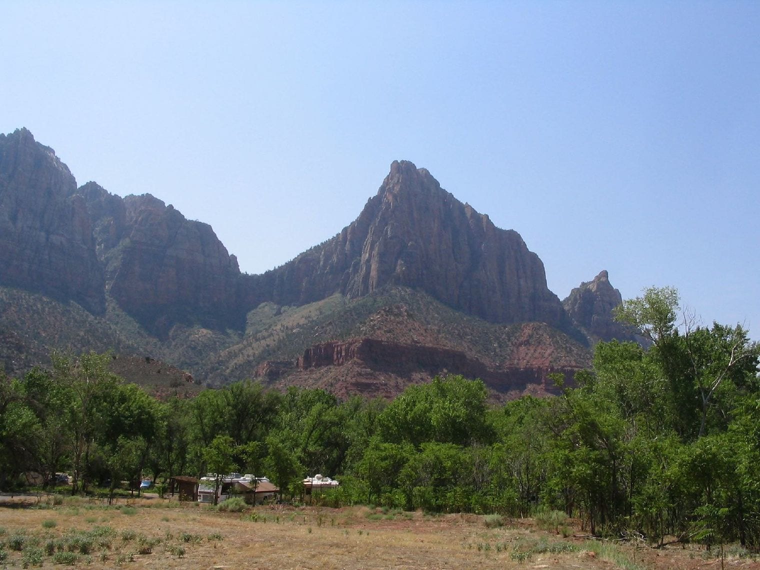
Zion became Utah's first national park in 1919: as the Park Service records it, in 1918 Mukuntuweap National Monument became Zion National Monument, and in 1919 the name changed again to Zion National Park.
Everything else in the Mighty Five followed it. Zion set the pattern for how Utah's canyon country would be protected, and for how the rest of the country would come to picture the state at all.
5. Zion Began Life Under the Name Mukuntuweap
On July 31, 1909 President Taft set aside approximately 16,000 acres for Mukuntuweap National Monument, the Paiute-derived name the canyon carried before it was Zion.
The rename was a marketing decision as much as anything: officials worried the original name was too hard for visitors to say. What was lost in the swap was the older claim on the place, which is why the first name is worth knowing.
6. The Narrows Runs Just 20 Feet Wide in Places
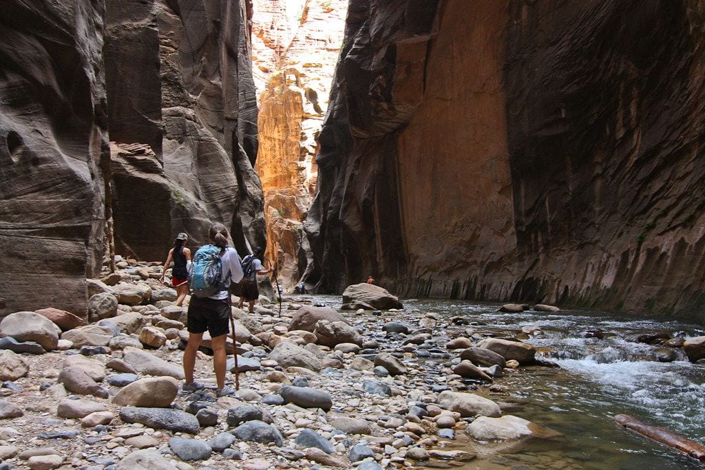
In The Narrows the canyon closes to a slot where, the Park Service says, the gorge has walls 1000 feet tall and the river sometimes only 20-30 feet wide.
There is no path. The Virgin River is the trail, and you walk up it. That is why the hike closes on high water and why flash-flood forecasts, not trail conditions, decide whether anyone goes in.
7. Zion Holds More Than 1,000 Plant Species
Zion supports more than 1,000 species of plants, ranging from the cottonwoods along the river to the pines and firs on the high ground.
That range is a function of water in a desert. The river bottom, the seeps in the cliff walls and the dry benches above them are effectively three different climates stacked inside one canyon.
8. Zion Spans 5,000 Feet of Elevation
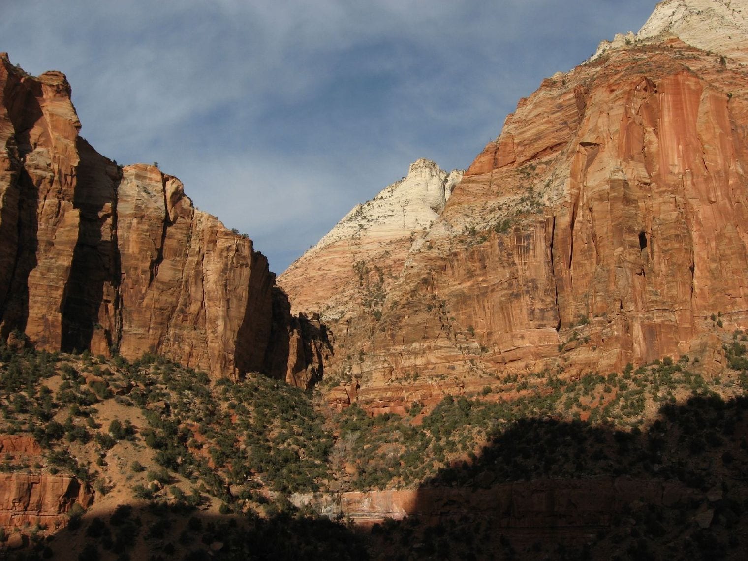
The park covers an elevation change of about 5,000 feet — from the highest point at Horse Ranch Mountain at 8,726 feet to the lowest point at Coal Pits Wash at 3,666 feet.
Climb that in a day and you pass through country that belongs to different worlds: desert scrub at the bottom, conifer forest at the top. It is the reason a single park can hold both a hanging garden and a fir stand.
9. Bryce, Zion and the Grand Canyon Are One Rock Stack
The three parks are rungs of one tilted staircase of rock. As the Park Service puts it, the bottom layer of rock at Bryce Canyon is the top layer at Zion, and the bottom layer at Zion is the top layer at the Grand Canyon.
Drive south from Bryce and you are descending through geological time, layer by layer. The Grand Staircase is not a metaphor; it is a single sequence of stone that happens to be sliced open in three famous places.
10. Every Angels Landing Hiker Needs a Permit
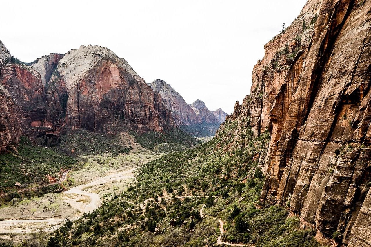
As of 2026, everyone who hikes Angels Landing needs to have a permit, awarded by a lottery that began in 2022, and rangers may ask to see it anywhere on the trail.
The programme exists because the final ridge is a chain-assisted scramble with long drops on both sides, and the queues that built up on it were themselves the hazard. Winning the lottery is now part of planning the hike.
11. Walter's Wiggles Stacks 21 Switchbacks Up a Cliff
The last climb before Scout Lookout is a series of 21 steep switchbacks named after Walter Ruesch, the first superintendent for Zion National Park, who constructed them in 1926.
They were cut into a wall that had no business carrying a trail, and they still do the job a century on. Counting them on the way up distracts from how much work it took to put a trail there at all.
12. You Cannot Drive Zion's Scenic Drive in Season
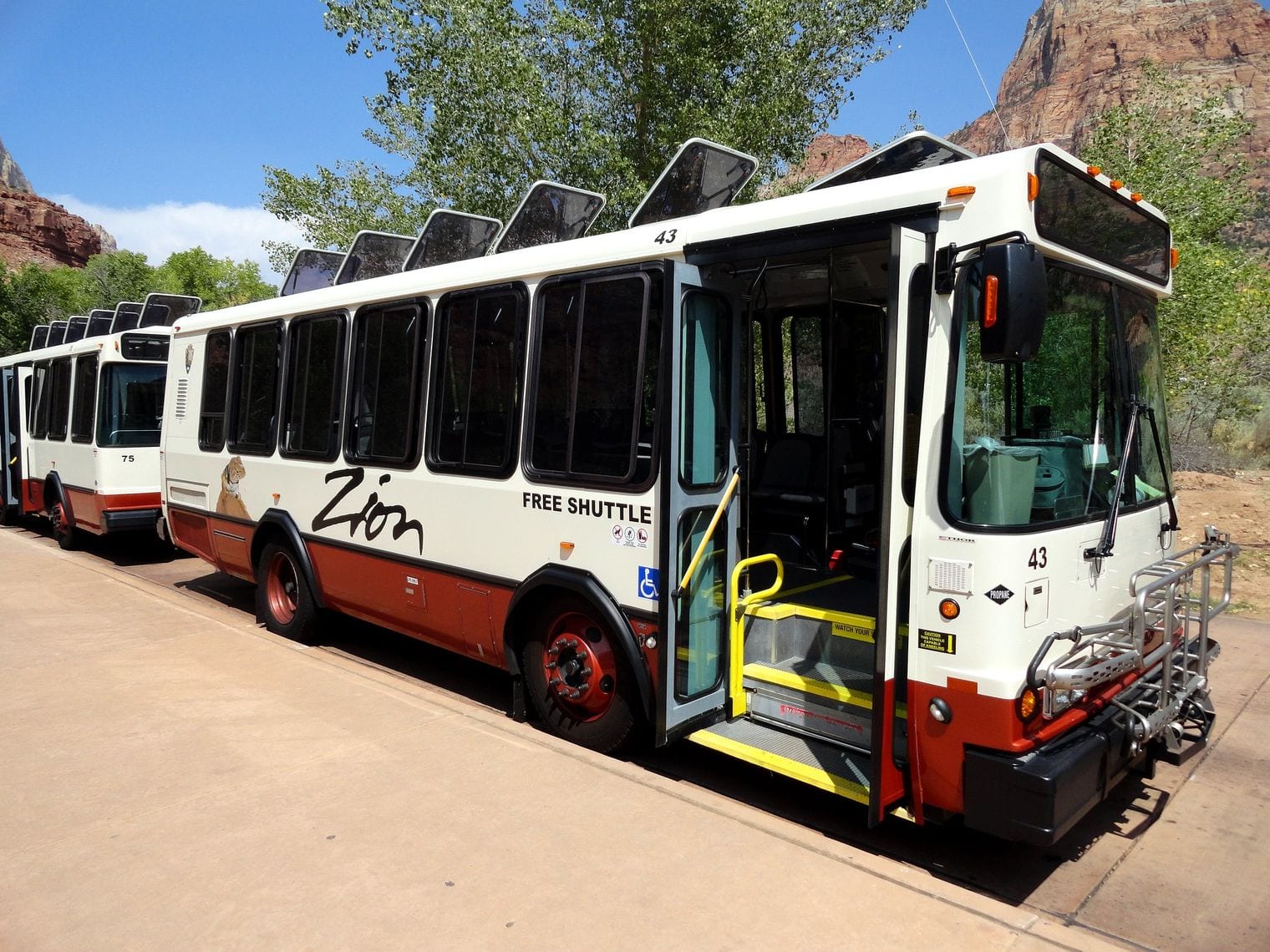
For most of the year private cars are barred from the main canyon road: during the shuttle season, visitors cannot drive personal vehicles on the Zion Canyon Scenic Drive, and the free park shuttle is the only way up.
The rule was brought in because the canyon simply ran out of parking. It has become one of the more successful crowd fixes in the park system, and it means the road is quieter than the visitor numbers suggest. That figure is current as of 2026.
13. Bryce Canyon Is Not Actually a Canyon
Despite the name, Bryce Canyon is not a canyon but a collection of giant natural amphitheaters along the eastern side of the Paunsaugunt Plateau.
A canyon is cut by a river running through it. Bryce was eaten backwards into the edge of a plateau by frost and runoff, which is a different process producing a different shape — a bowl bitten out of a rim, not a channel.
14. Bryce Claims the Largest Hoodoo Collection on Earth
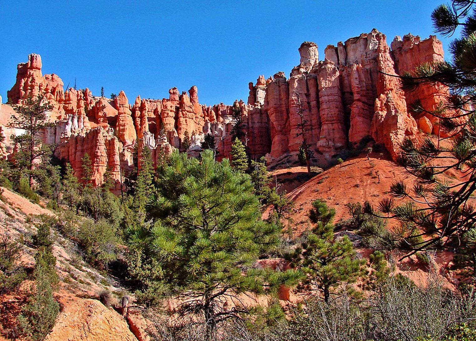
The Park Service says its park is famous for the largest collection of hoodoos in the world — the thin rock spires left standing when ice and rain pick apart weak limestone.
Hoodoos form elsewhere, but rarely in this density or this colour. The Claron limestone here is soft enough to carve quickly and just hard enough on top to leave the columns standing once the surrounding rock is gone. Current as of 2026.
15. Freezing Water Expands 9% and Splits Bryce Apart
Bryce is carved mostly by ice. Water seeps into cracks and, as the Park Service explains, when water freezes into ice, it expands by 9%, which puts tremendous pressure on the surrounding rock and breaks it apart.
The park crosses freezing point on a great many nights a year, so the process runs on a nightly cycle. The hoodoos you photograph are mid-demolition; the park is quietly taking itself to pieces.
16. Bryce Canyon Offers Views of Over 100 Miles
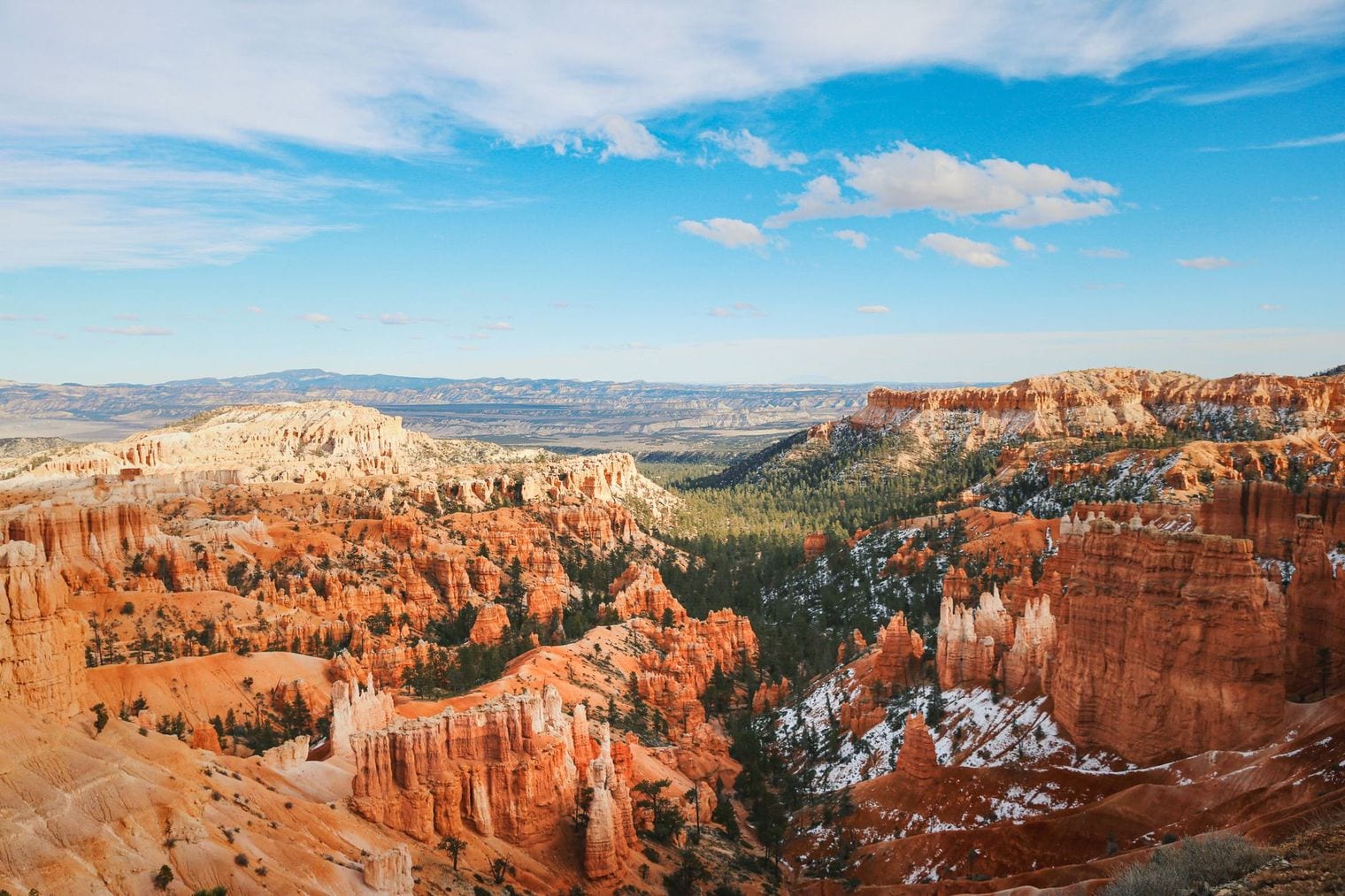
The air is clean enough that the park's southern overlooks give views of over 100 miles, and on the clearest days mesas 160 miles off in Arizona and New Mexico come into sight.
That is a measure of Bryce Canyon air quality as much as of elevation. Very few places left in the lower 48 offer sightlines like it, which is part of why the park is also a dark-sky destination.
17. About 7,500 Stars Are Visible Over Bryce Canyon
The Bryce Canyon night sky is a 7.4 magnitude night sky, one of the darkest in North America, where approximately 7,500 stars can be picked out without a telescope.
Under a city sky, far fewer are visible. The park runs astronomy programmes on the strength of it, and the Milky Way reads as a solid band rather than a smudge. That was still the position as of 2026.
18. Landscape Arch Spans 290 Feet of Thin Sandstone
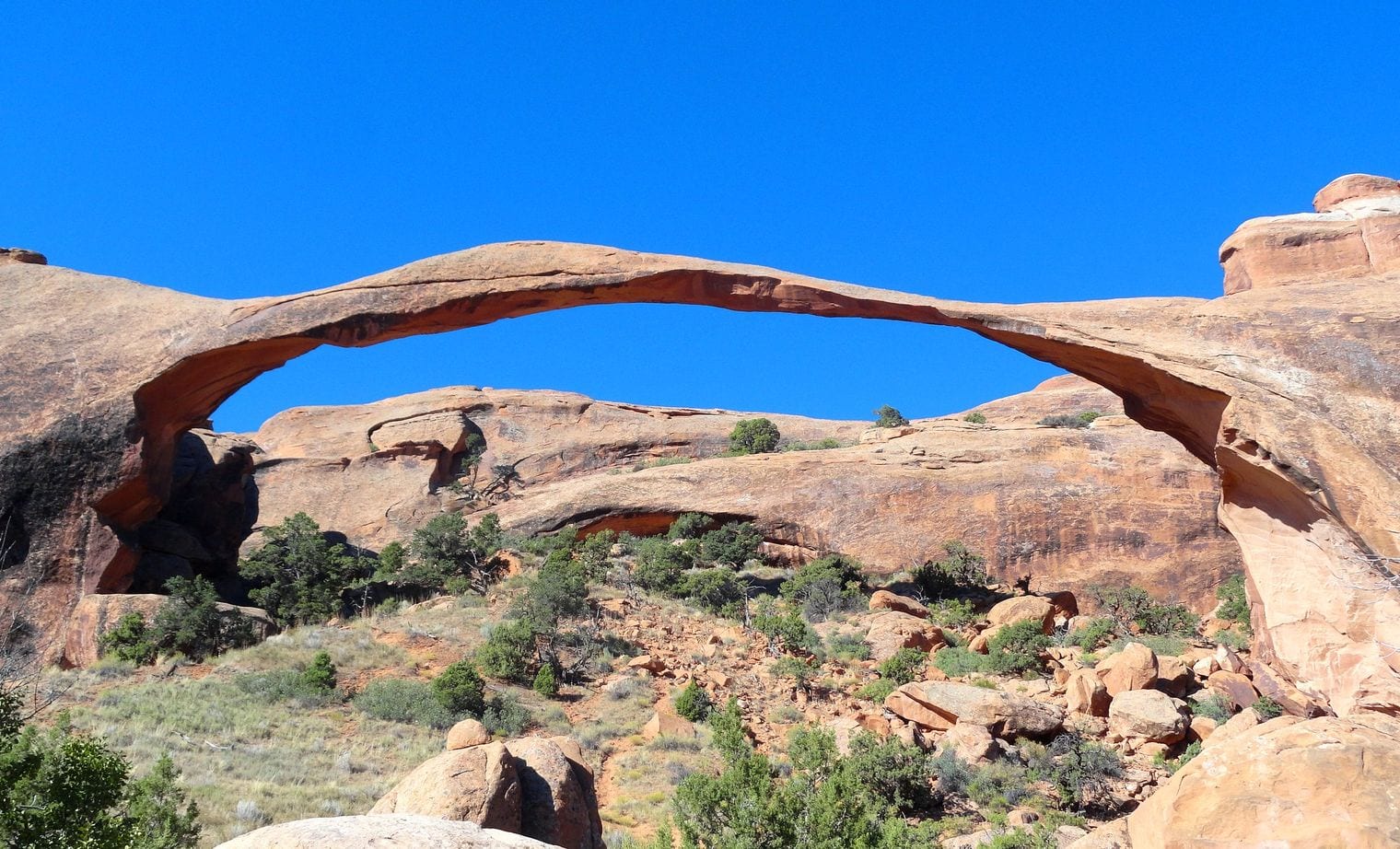
Landscape Arch was measured in 2004 at a span of 290.1 ft, with a height of 77.5 ft — the longest arch in the park and, by the Natural Arch and Bridge Society's reckoning, the fifth longest natural arch in the world.
The ribbon of rock is just a few feet through at its narrowest. Slabs fell off it in the 1990s and the trail underneath was closed permanently; nobody is allowed to stand beneath it now. Current as of 2026.
19. Wall Arch Collapsed Overnight in August 2008
Wall Arch, on the Devils Garden Trail, collapsed sometime on August 4/5, 2008, with nobody there to see it go.
It is the clearest reminder the park offers that every arch here is temporary. The same processes that opened these spans are still working on them, and the park's inventory is a snapshot rather than a permanent list.
20. Arches Are Made When Fins of Rock Wear Through
An arch starts as a fin — a thin upright wall of sandstone standing between parallel cracks. As the Park Service describes it, little by little, this process turns fractured rock layers into fins, and fins into arches, and water also dissolves small honeycomb formations called tafoni.
So the arches are not carved by wind, whatever the postcards imply. They are the last standing pieces of walls that water and ice took apart from the inside.
21. Fifteen Miles of 1869 Railroad Grade Still Survive
At Golden Spike, visitors can explore fifteen miles of the historic grade that was prepared for track by the two railroad companies in 1869.
The rails themselves were pulled up long ago, but the earthwork remains — cuts, fills and embankments dug by hand across the Promontory country. Walking it is the closest thing to standing in the construction race itself.
22. Delicate Arch Is Called the Most Famous Arch on Earth
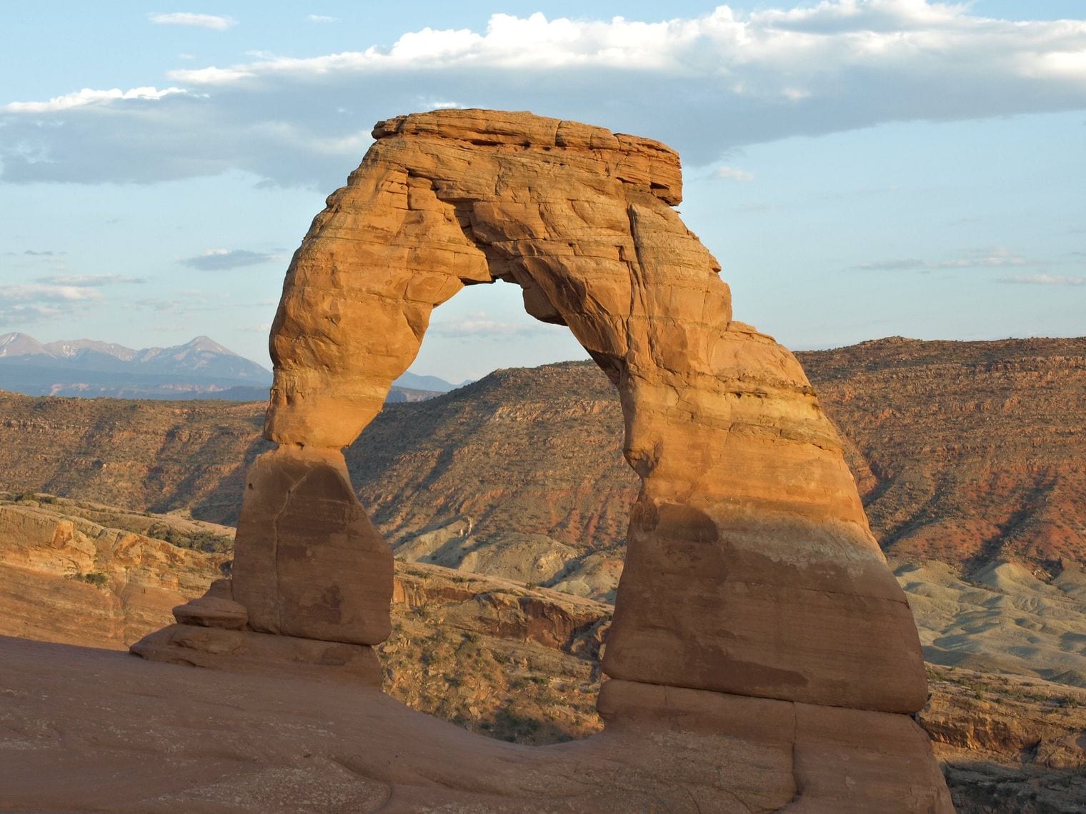
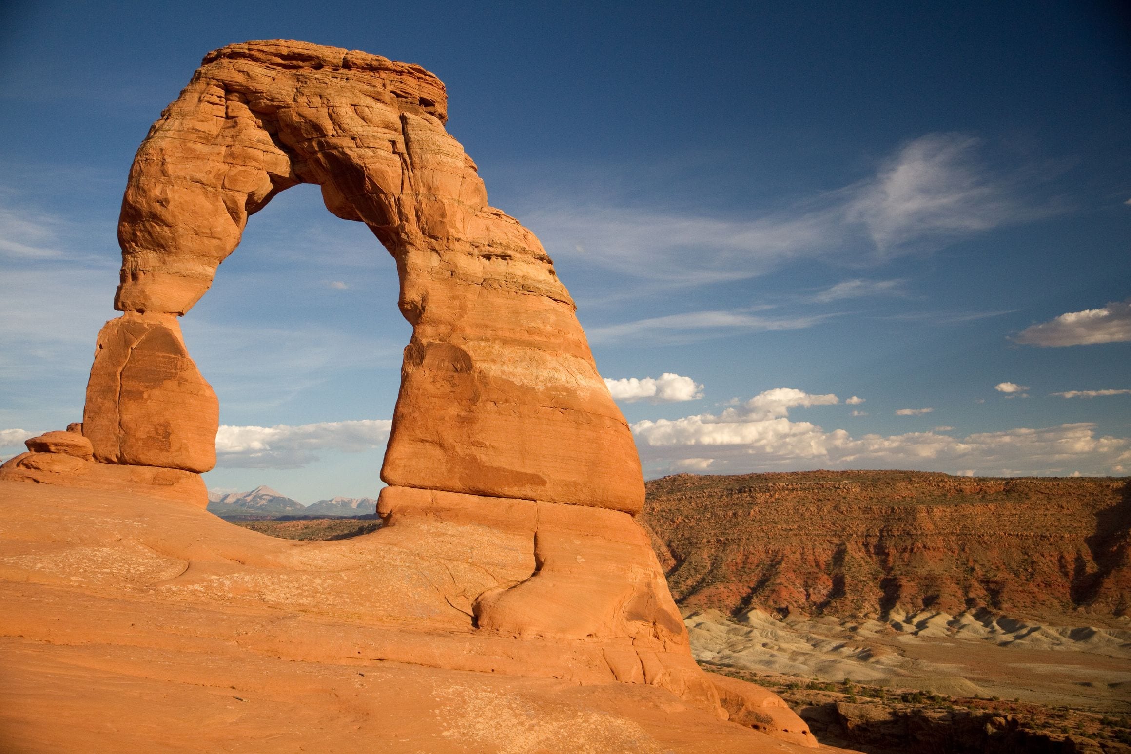
The Park Service calls it plainly: Delicate Arch is perhaps the most famous natural arch in the world, and the walk out to it climbs 480 feet over three miles of open slickrock.
There is no shade and no railing, and the arch stays hidden until the last few steps, when the trail rounds a rock wall and drops you straight onto the rim of its bowl. The reveal is the whole design of the hike. Current as of 2026.
23. Canyonlands Has Four Districts and No Road Joins Them
Canyonlands is cut apart by its own rivers: the park is divided into four distinct districts; no roads join them together.
Standing at Island in the Sky you can see the Needles across the gorge and still face a drive of several hours to reach it. Many people see a single district and leave assuming they have seen the park.
24. Canyonlands Is Utah's Largest National Park
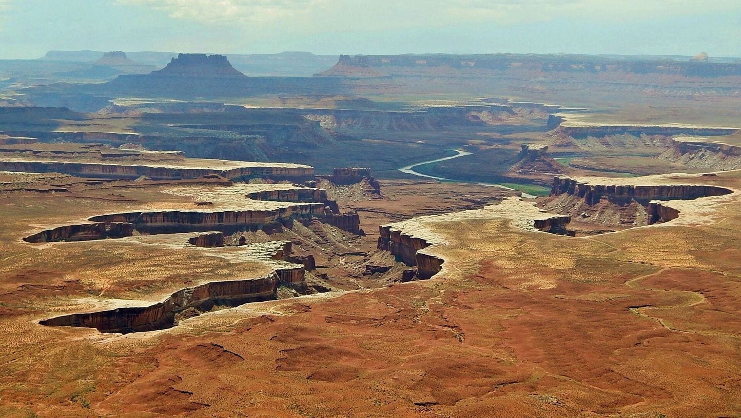
By area it beats the other four: Canyonlands is Utah's largest national park, with 337,598 acres of land and water ready to be explored.
It is also the least visited of the Mighty Five, which is the direct consequence of the districts problem — there is no single road tour that takes it in, so it never became a stop on the loop. That figure is current as of 2026.
25. Park City Grew Rich on Silver Long Before Skiing
Before the resorts, there were mines. The state tourism office frames the town through its silver mining heritage, artistic energy and outdoor enthusiasm.
The slopes that later carried Olympic events were tunnelled through and dug over by miners long before anyone skied them. Some of the ski runs still follow old haulage routes, and the town below them was built for men coming off shift, not for visitors.
26. The Waterpocket Fold Is a 100-Mile Wrinkle in the Earth
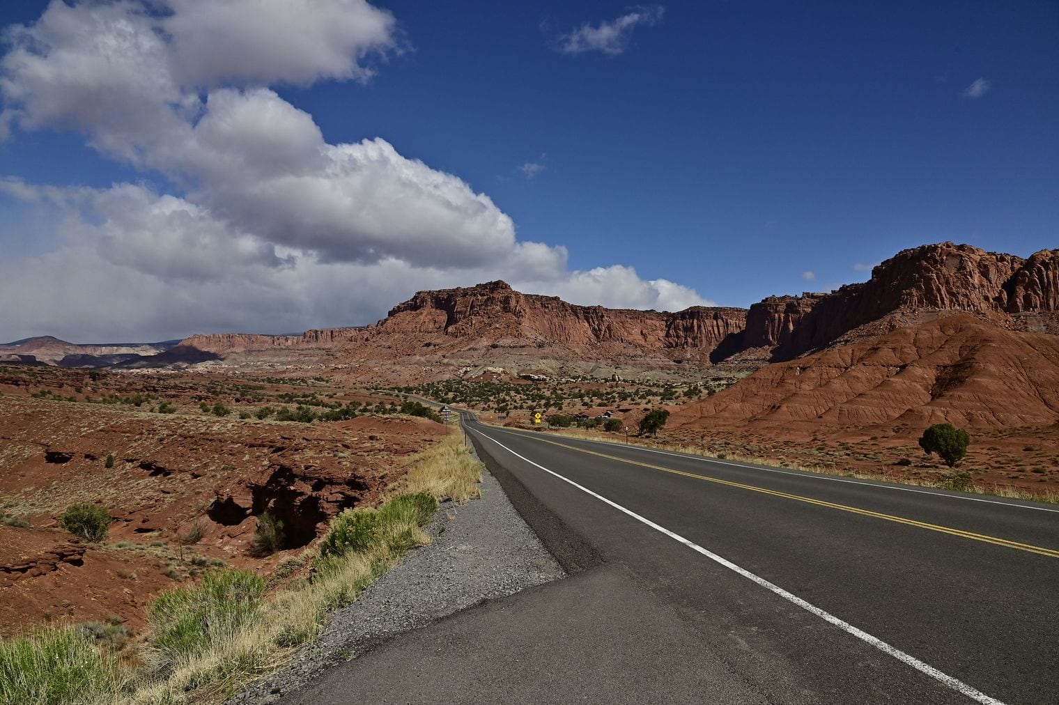
Capitol Reef exists to protect one structure: a nearly 100-mile long warp in the Earth's crust, the Waterpocket Fold is a classic monocline, a step-up in the rock layers — and the largest exposed monocline in North America.
A monocline is a single bend rather than a series of folds, as if the crust were a rug pushed into one long ridge. Erosion has since sliced it open lengthways, which is why you can read the whole structure from the road. Current as of 2026.
27. One Side of Capitol Reef Sits 7,000 Feet Higher
The displacement across the fold is enormous: the rock layers on the west side of the fold have been lifted more than 7,000 feet higher than the layers on the east.
Walk east across the park and you walk forward through geological time, crossing from older rock onto younger. The same bed of stone that forms a cliff on one side lies buried far below your feet on the other.
28. Capitol Reef Is Named for Domes and a Barrier Reef
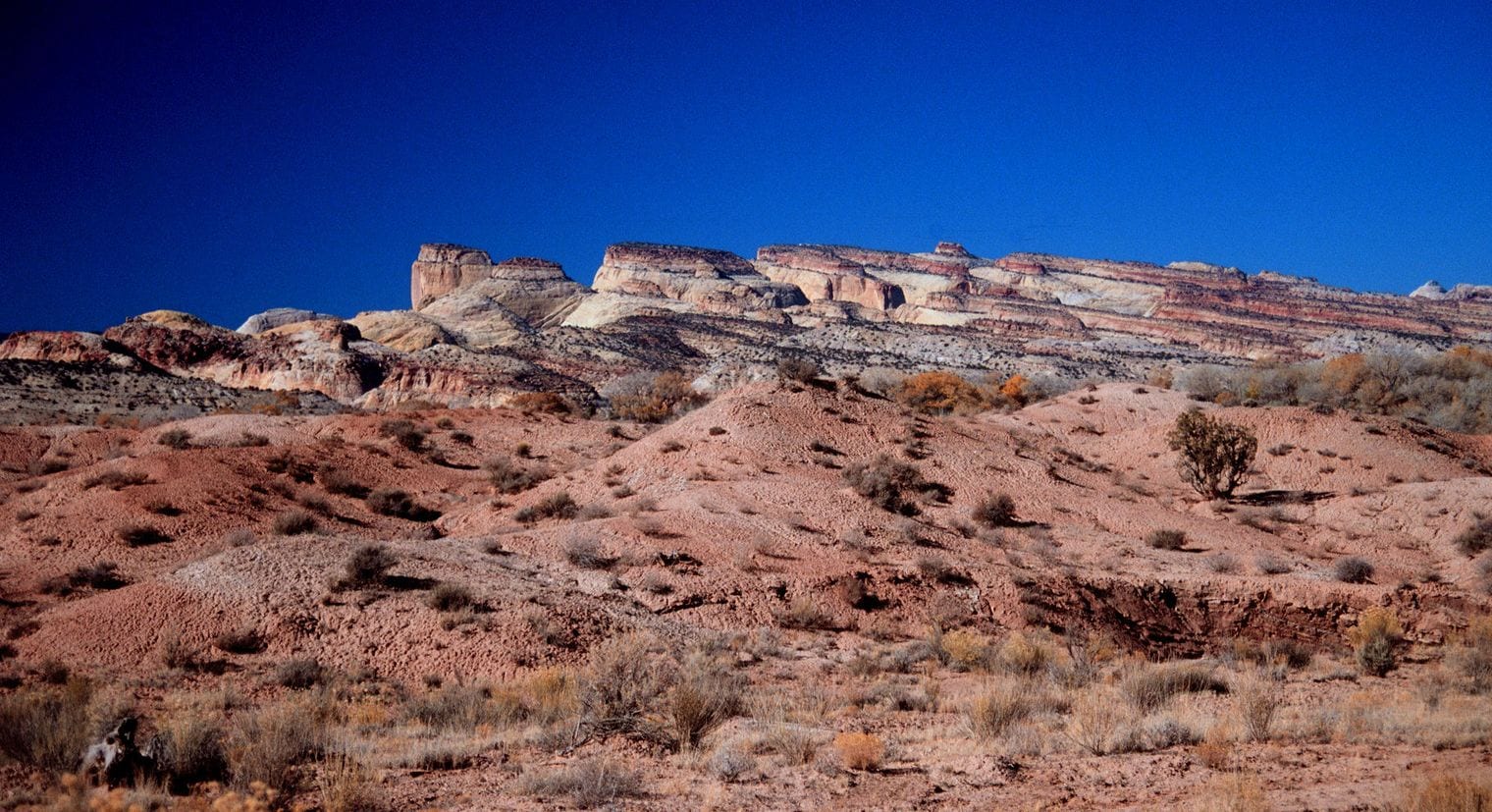
The name is two jokes stacked together. It was named for its whitish Navajo Sandstone cliffs with dome formations, similar to the white domes often placed on capitol buildings; locally, reef refers to any rocky barrier to land travel.
So it is neither a capitol nor a reef. It is a wall of rock that stopped wagons, topped by lumps that reminded somebody of Washington.
29. A National Park Keeps 2,500 Fruit Trees You Can Pick
Capitol Reef maintains the pioneer orchards of Fruita, which have about 2,500 trees under Park Service ownership, pruned, irrigated and replanted as a historic landscape.
When a block is ripe the park opens it and visitors pick and pay by the pound. It is the only national park in the country where the correct thing to do with the scenery is eat it. That was still the position as of 2026.
30. Fruita Was Once the Eden of Wayne County
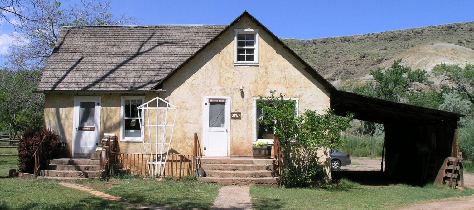
The settlement inside the park prospered on fruit until, as the Park Service records, before the turn of the century Junction was known as "the Eden of Wayne County." In 1902, the name of the little settlement was changed to Fruita.
The town was bought out and emptied when the park absorbed it. The orchards, a schoolhouse and a farmhouse are what survive, which makes Fruita less a ghost town than a working exhibit of one.
31. Rainbow Bridge Stands Nearly as Tall as Liberty
The Park Service measures it this way: from its base to the top of the arch, it is 290 feet — nearly the height of the Statue of Liberty — and spans 275 feet across the river; the top of the arch is 42 feet thick and 33 feet wide.
Many arrive by boat across Lake Powell and still have a walk at the end. The scale does not read from photographs; there is nothing beside it to give the eye a reference.
32. Rainbow Bridge Is Sacred to Five Native Nations
The bridge is not simply scenery. Native Americans living in the region have long held the bridge sacred, and five nations are formally affiliated with it — the Navajo, Hopi, San Juan Southern Paiute, Kaibab Paiute and White Mesa Ute.
The Navajo name, Nonnezoshe, means rainbow turned to stone. Visitors are asked not to walk under the arch, a request that comes from the nations rather than from the Park Service.
33. Natural Bridges Was Protected Back in 1908
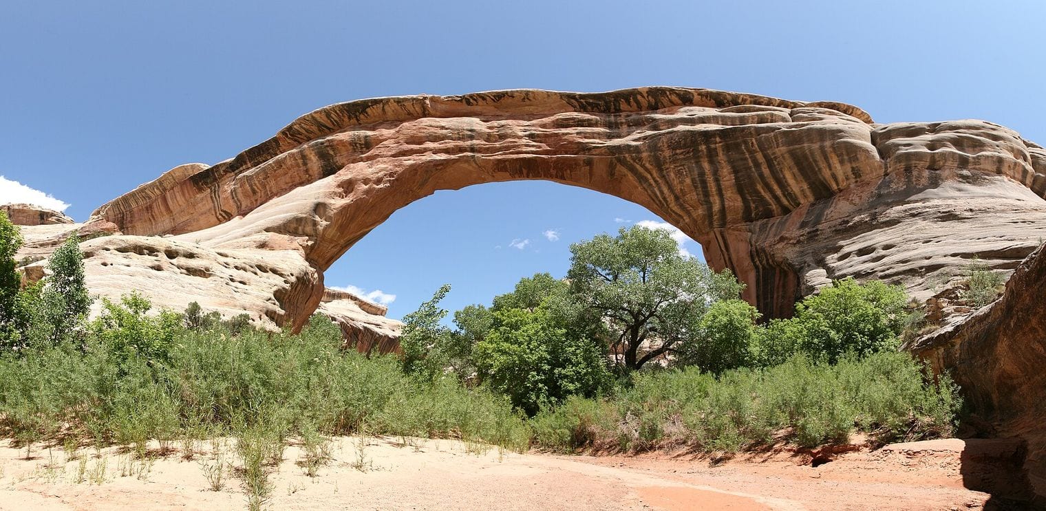
Theodore Roosevelt signed it into being early: the area was designated a National Monument on April 16, 1908, four years after National Geographic publicised the bridges to the outside world.
The magazine article did the work; the proclamation followed the publicity.
34. Three Bridges Carry Hopi Names in Utah's Desert
The monument protects three spans formed by streams cutting through canyon walls, the largest of which is named Sipapu Bridge with a span of 225 feet; the others are Kachina and Owachomo, and all three names are Hopi.
The distinction matters here: a natural bridge is cut by running water, an arch by weathering. These are bridges, and the creeks that made them are still in the canyon bottoms doing the work. Current as of 2026.
35. Hovenweep's Towers Balance on Boulders and Rims
Hovenweep preserves stone towers that its builders perched in improbable places — the towers of Hovenweep were built by ancestral Puebloans, a farming culture that occupied the Four Corners area from about 500 to 1300 CE.
Some sit squarely on top of freestanding boulders, shaped to the rock beneath them. Nobody is certain what they were for: granaries, watchtowers, observatories and ceremonial rooms have all been argued from the same walls.
36. Timpanogos Cave Is Crowded With Helictites
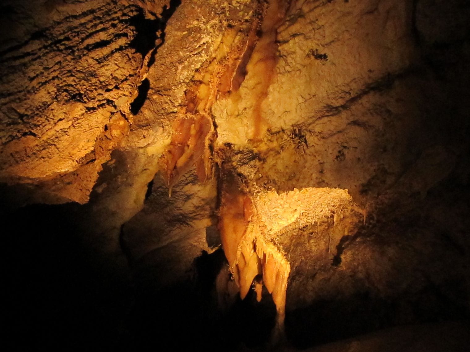
The cave system is unique due to its high abundance of helictites, its coloration in its formations, its display of fault-controlled passages, its alpine surroundings, and unique history.
Helictites are the formations that appear to ignore gravity, growing sideways and upward in twisted threads. They are uncommon anywhere; a cave full of them is the reason this small monument exists at all.
37. You Climb 1,092 Feet Before the Cave Tour Starts
There is no lift and no road to the entrance. The approach trail is 1.5-mile-long and gains 1,092 feet in elevation, cut into the wall of American Fork Canyon.
The Park Service warns that the path is narrow and steep with drop-offs on one side. It is the rare cave tour where the hardest part happens in daylight, before you reach the door.
38. Bears Ears Protects 1.36 Million Acres
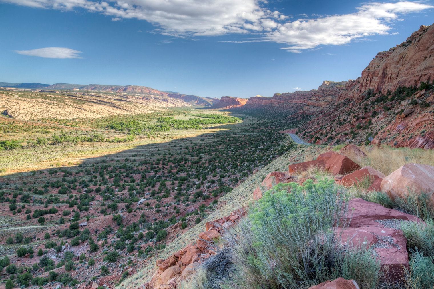
Bears Ears is, in the Bureau of Land Management's words, made up of 1.36 million acres of public lands administered jointly with the BLM and U.S. Forest Service, in San Juan County.
What makes it unusual is the co-management arrangement with a coalition of five tribal nations, which have ancestral ties to the region. Very little American public land is governed that way, and the boundaries have moved twice by proclamation. Current as of 2026.
39. Great Salt Lake Is the Biggest Saline Lake in the West
The state describes it without hedging: Utah's Great Salt Lake is the largest saltwater lake in the Western Hemisphere and the eighth largest in the world.
It is also shallow enough that a small drop in level exposes a great deal of lakebed, which is why its surface area moves so dramatically from year to year while its rank does not. That remained the case as of 2026.
40. Three Rivers Flow Into the Lake and None Flow Out
Great Salt Lake hydrology runs one way. As the state puts it, three rivers flow into the lake — the Bear River, Weber River and Jordan River — but no water flows out of it, making it a "terminal" lake.
Everything the rivers carry in stays in. Water leaves by evaporation alone, and the salt it leaves behind has been concentrating for a very long time, which is the whole explanation for how the lake tastes.
41. The Lake Shrank to About 800 Square Miles in 2022
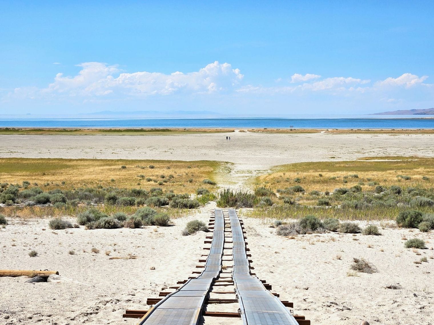
The low point is recent and it is documented: Great Salt Lake hit a new historic low in November 2022, only covering about 800 square miles.
Because the lake is shallow and its basin is broad, losing depth costs it an enormous amount of surface. Whole bays became dry ground, boat ramps ended in salt flats, and islands stopped being islands. That was still the position as of 2026.
42. Great Salt Lake Stood at 4,189.8 Feet in September 2026
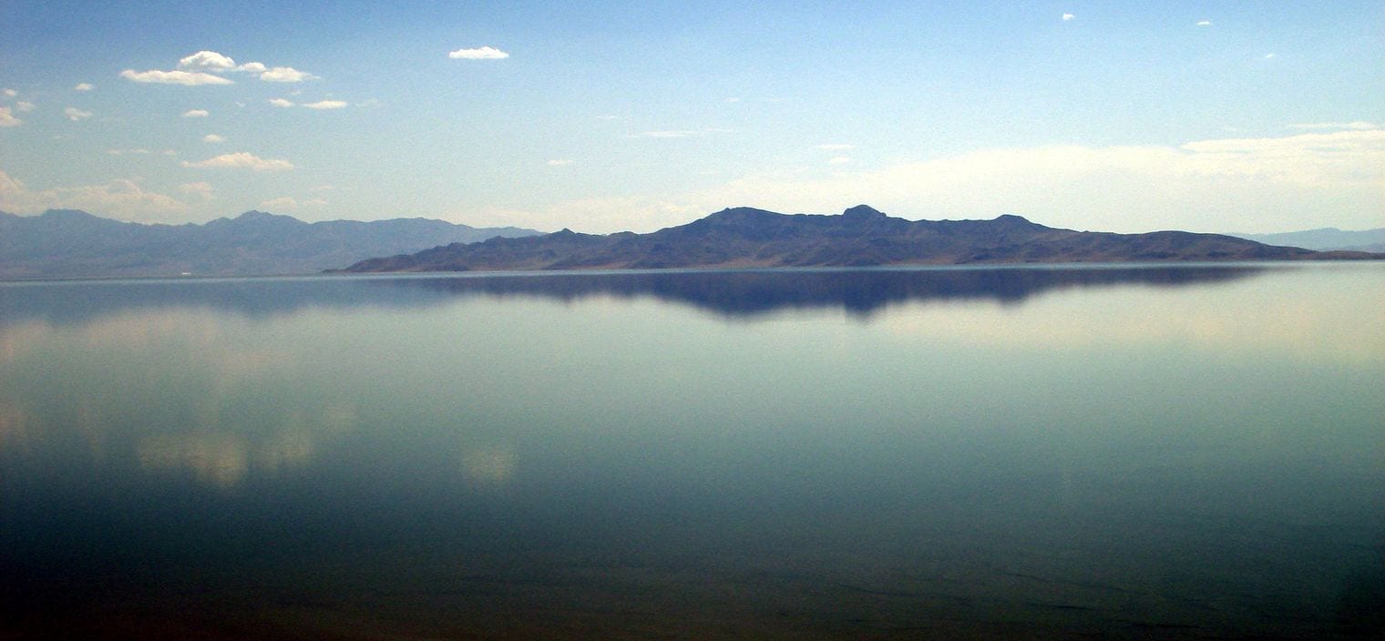
Read the gauge and you get the current state of it: on 5 September 2026 the USGS station at Great Salt Lake at Saltair Boat Harbor recorded a surface elevation of 4,189.8 feet.
That is above the record low but not by much. Any figure about this lake needs a date attached, because the number moves every season and the ones printed in older guidebooks are no longer true.
43. Great Salt Lake Salinity Swings From 5% to 27%
There is no single salinity for this lake. The salinity of the lake's main basin, Gilbert Bay, is highly variable and depends on the lake's level; it ranges from 5 to 27%, and the northern arm is substantially saltier still.
A railway causeway splits the lake and mostly stops water mixing across it, so the two halves have drifted into different chemistries — and different colours, which is why the northern arm photographs pink from the air. That remained the case as of 2026.
44. Utah Supplies Much of the World's Brine Shrimp Eggs
The lake feeds an export industry: it provides 35% to 45% of the worldwide supply of brine shrimp cysts, harvested off the surface each winter.
Those cysts are shipped abroad and hatched to feed farmed prawns and fish. It is a genuinely global supply chain running out of a lake many visitors write off as an empty, smelly novelty. That figure is current as of 2026.
45. The Brine Shrimp Became a State Symbol in 2023
Utah made the brine shrimp its official state crustacean in 2023 — the state Division of Wildlife Resources manages the commercial harvest of brine shrimp cysts, a multimillion dollar business for which the Great Salt Lake is world renowned.
It is an unusual honour for an animal you need to squint to see. But the shrimp are the hinge of the whole ecosystem: they eat the algae and the migrating birds eat them.
46. The Bear River Never Reaches the Sea
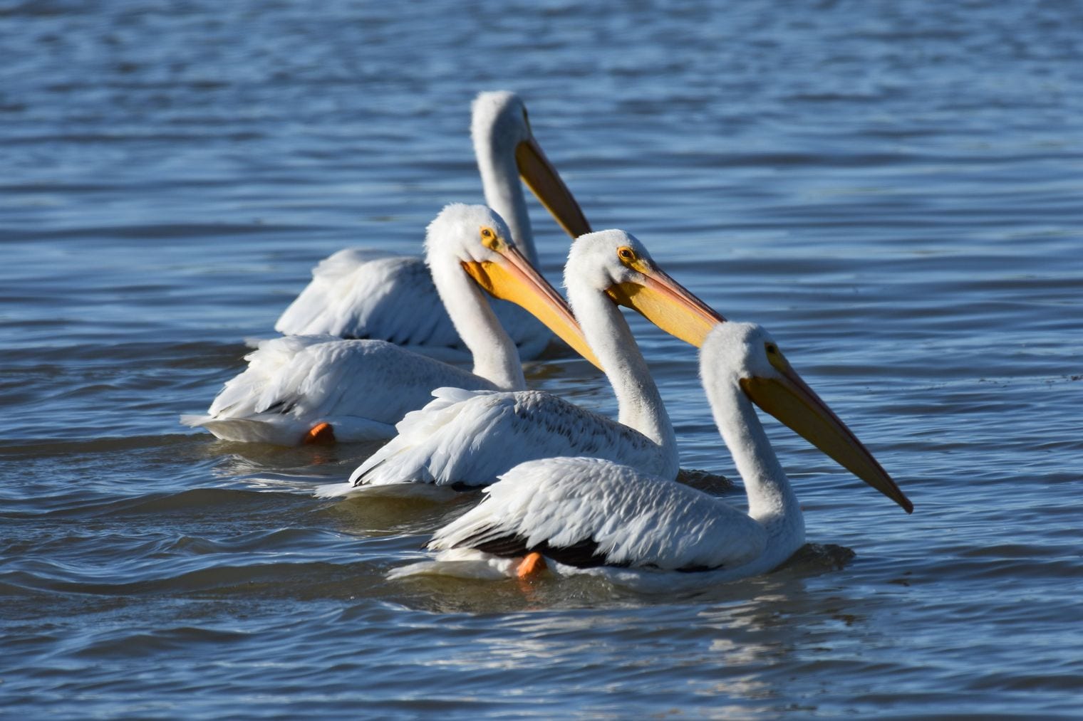
The Bear River is approximately 350 miles long and is the longest river in North America that does not ultimately reach the sea. It simply ends in Great Salt Lake.
It loops through three states and comes back on itself before emptying into the lake, and the wetlands at its mouth are important bird habitat in the interior West. Current as of 2026.
47. Lake Bonneville Once Covered a Third of Utah
Great Salt Lake is what is left of something far bigger: Lake Bonneville covered approximately 1/3 of Utah and was almost 1000 feet deep in the area of the Salt Flats.
Its old shorelines are still legible as terraces cut into the mountains above Salt Lake City. Once you know what they are, you cannot unsee them — level benches running for miles along the range front, marking where the water stood.
48. The Bonneville Salt Flats Cover 30,000 Acres
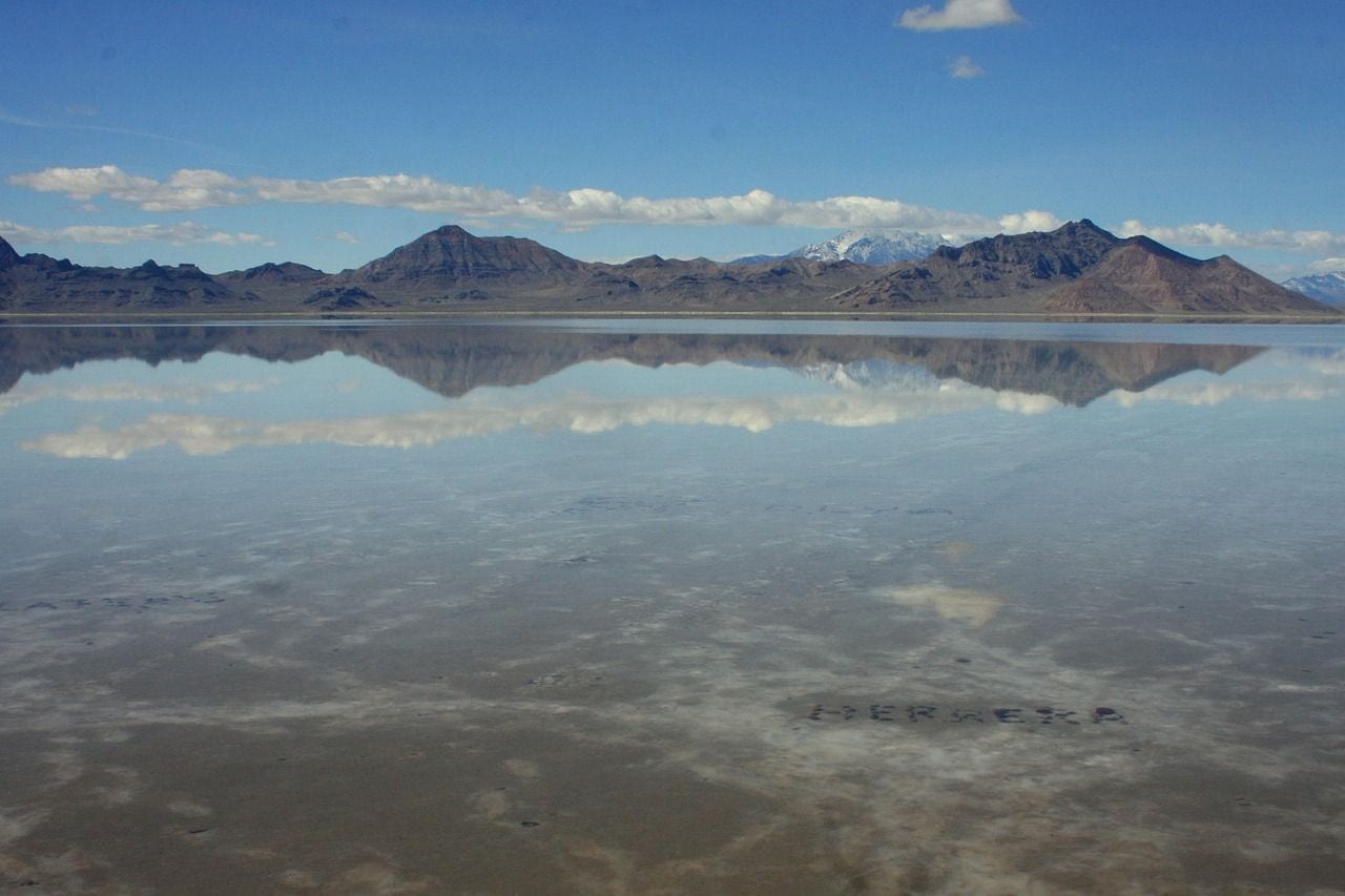
The BLM describes them plainly: the salt flats are a 30,000 acre expanse of hard, white salt crust on the western edge of the Great Salt Lake Basin in Utah, about twelve miles long and five miles wide.
They are made mostly of ordinary table salt, and they are flat enough that the curvature of the earth becomes the limiting factor on what you can see. Mountains on the far side appear to float.
49. The Salt Crust Is Five Feet Thick at the Middle
The crust is not uniform. Near the center of the salt, the crust is almost 5 feet thick in places, with the depth tapering off to less than 1 inch as you get to the edges.
That gradient decides where the race courses go. It also explains why the flats are fragile at the margins, and why driving out onto them casually is a good way to break through into mud.
50. Cars Have Raced the Salt Flats Since 1914
Speed came here early: since 1914, this majestic landscape has served as the racing grounds for generations of land speed racers from around the world.
The first attempt was an unofficial run by the daredevil Teddy Tetzlaff. Everything since — the salt-encrusted streamliners, the Speed Week meets, the record books — descends from somebody deciding this white nothing was a racetrack.
51. Kings Peak Tops Out at 13,528 Feet
Kings Peak is the highest peak in the U.S. state of Utah, with an elevation of 13,528 feet, and it sits inside the High Uintas Wilderness.
There is no road anywhere near it. Reaching the summit is a multi-day walk in, which makes it one of the harder state high points in the country to collect — a long way from the drive-up summits some states offer.
52. The Uintas Are the Highest East-West Range in the US
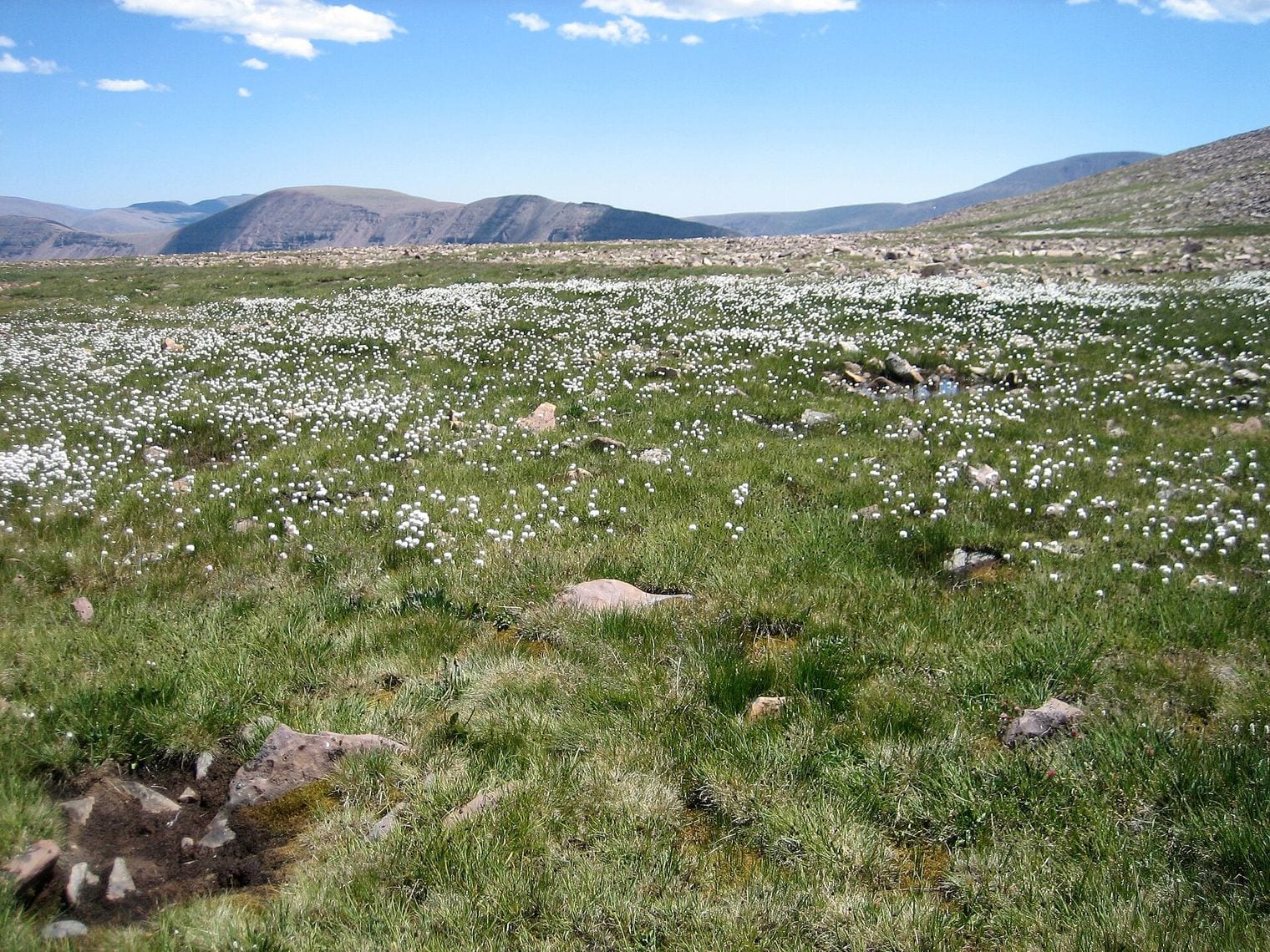
Almost every major American range runs north to south. The Uintas do not: they are unusual for being the highest range in the contiguous United States running east to west.
The orientation is a quirk of how the crust buckled here, and it has real consequences — the slopes face north and south rather than east and west, which changes where the snow lingers and where the forests grow. That figure is current as of 2026.
53. Utah Is the Only Place Four States Touch
Four Corners is genuinely unique: it is the only location in the United States where four states meet — Utah, Colorado, Arizona and New Mexico.
The monument marking it is run by the Navajo Nation, not the federal government, and the surveyors who set the original point were working with nineteenth-century instruments across very difficult country.
54. Utah's Coldest Night Hit Minus 69 Degrees
In a limestone sinkhole in the Bear River Range, on February 1, 1985, a temperature of −69.3 °F was recorded — the second-lowest temperature ever measured in the contiguous United States.
Nobody lives there, which is the point: the reading comes from a monitoring station in an uninhabited hollow, part of the network the Utah Climate Center operates across the state.
55. Cold Air Pools in Peter Sinks Like Water in a Bowl
The cold is a shape, not a latitude. On still, cloudless nights the basin sheds its heat and, as the record describes it, cool, dense air can then slide downwards towards the basin floor in a process known as cold-air pooling.
Because the hollow has no outlet, that air has nowhere to drain to. It simply sits and gets colder, which is how a spot in Utah can out-freeze places far to the north.
56. Utah Has the Densest Pile of Jurassic Dinosaur Bones
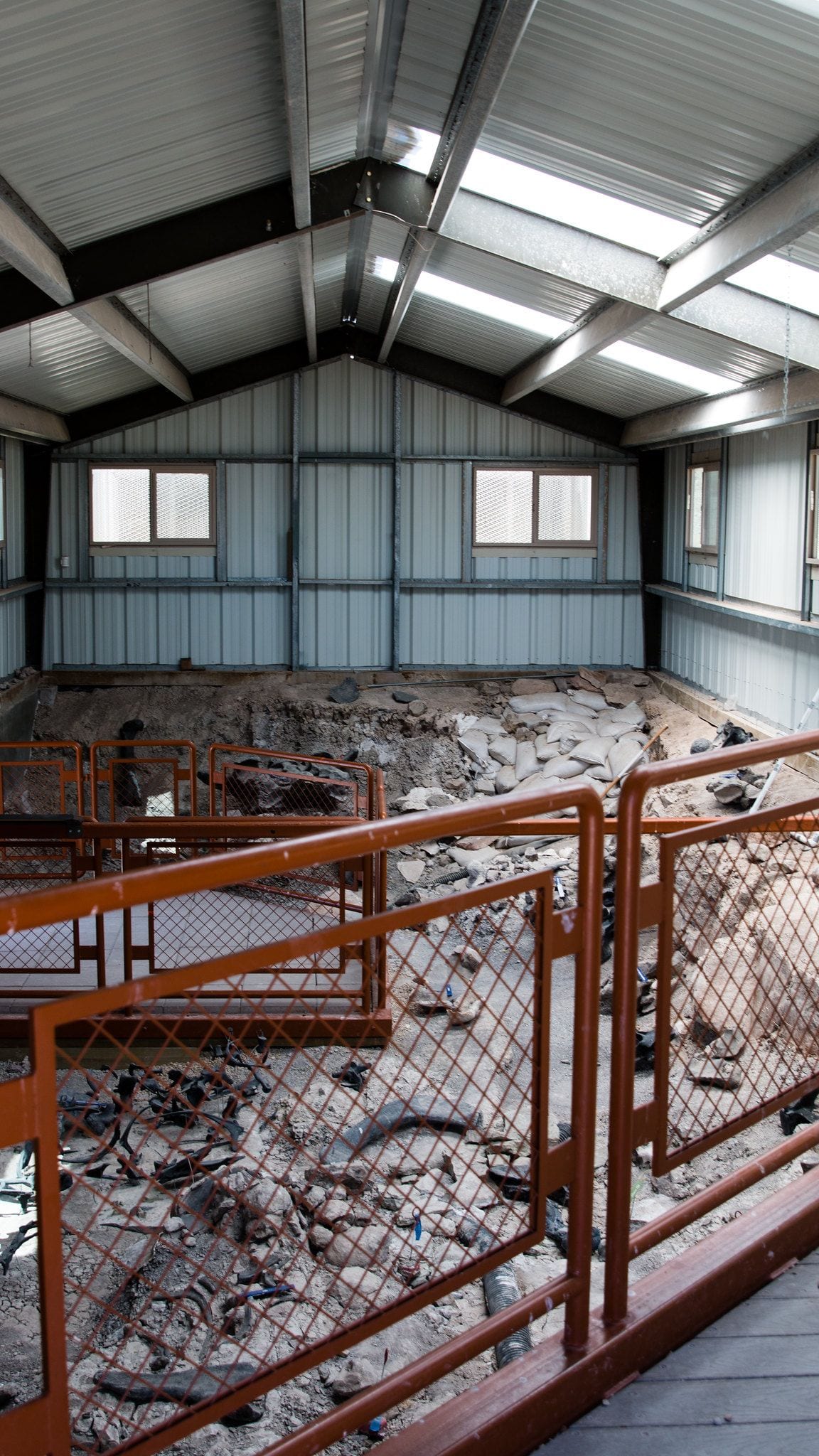
The Cleveland-Lloyd Dinosaur Quarry is extraordinary by any measure: it contains one of the densest concentrations of Jurassic-aged dinosaur bones ever found, with over 12,000 fossils representing at least 74 individual animals.
The bones are jumbled rather than articulated, which is part of the puzzle. Something concentrated these animals in one place and then took their skeletons apart before they fossilised. That figure is current as of 2026.
57. Three in Four Bones at the Quarry Are Predators
The ratio is backwards from every normal ecosystem: more than 75% of the bones come from predators like Allosaurus fragilis, with over 46 individuals identified.
In a living food web the prey vastly outnumber the hunters. A predator trap — a bog or mire that caught animals drawn in by earlier victims — is the leading explanation, but the site has resisted a settled answer for decades. That was still the position as of 2026.
58. More Allosaurus Turn Up in Utah Than Anywhere Else
According to the Natural History Museum of Utah, paleontologists have found more Allosaurus fossils in Utah than anywhere else on Earth — which is why the state adopted Allosaurus as its official fossil.
That abundance is scientifically useful as well as flattering. Having many individuals of one species lets researchers study how the animal grew and how much it varied, which single skeletons never allow. Current as of 2026.
59. A Utah Museum Shows the Most Horned Dinosaur Skulls
The Natural History Museum of Utah says its gallery holds dozens of skeletal reconstructions on display, including a Gryposaurus (duck-billed) dinosaur made of original fossil material, and the world's largest display of horned dinosaur skulls.
Most of them came out of southern Utah, from rock laid down when the region was the western shore of an inland sea. The horned dinosaurs found there turned out to be species nobody had seen before. That remained the case as of 2026.
60. A Cliff of 1,500 Dinosaur Bones Is Left in the Rock
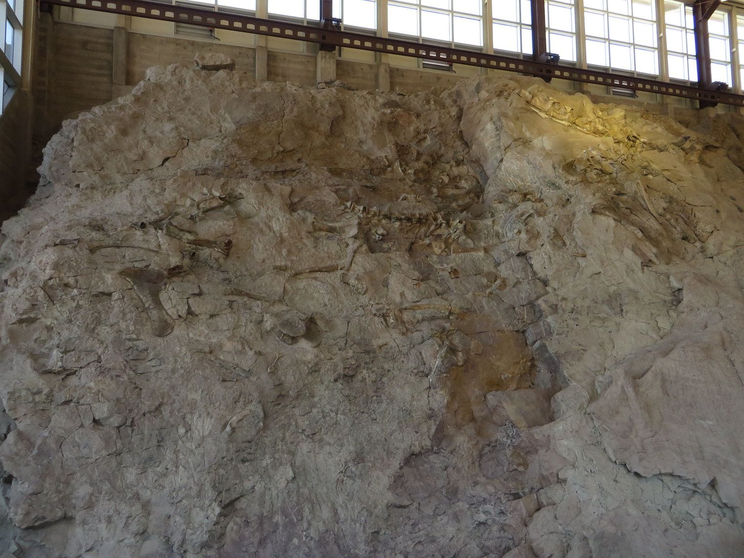
At Dinosaur National Monument the fossils were deliberately not removed: over 1500 fossilized bones of various dinosaurs are still embedded in the cliff face including a skull and several neck vertebrae of a camarasaurus.
A building was put up around the quarry wall instead, so visitors see the bones where they lie. It is the opposite of the usual museum arrangement, and it keeps the geology and the animals in the same frame.
61. The Transcontinental Railroad Was Joined in Utah
The country was stitched together here. The Park Service marks the site of the locomotives that met on May 10, 1869, and the four precious metal spikes honored at Golden Spike, at Promontory Summit.
Before that morning, crossing the continent took months; afterwards it took days. It is one of the few places where you can stand on the exact spot a country changed shape, and it is an hour and a half from Salt Lake City.
62. The Golden Spike Itself Now Lives in California
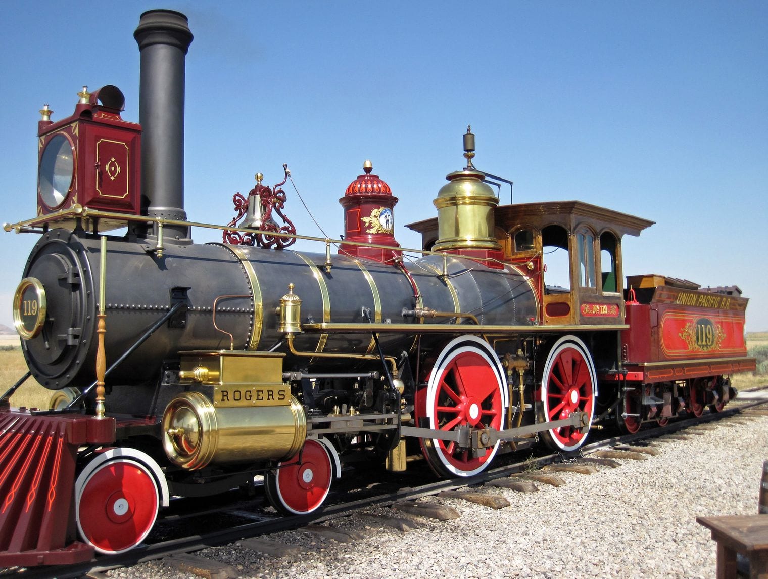
The ceremonial spike was made of 17.6-karat copper-alloyed gold, and weighed 14.03 troy ounces — and it left Utah almost immediately. The Park Service credits its photograph of the real object to the Cantor Arts Center at Stanford University, where it is displayed.
It was never meant to stay in the track. It was tapped in, pulled out and taken away the same day, and a plain iron spike went in to replace it. Current as of 2026.
63. The Pony Express Crossed Utah in Ten Days Flat
The Park Service sums the achievement up in one line: More than 1,800 miles in 10 days! — riding the Mormon Trail through Salt Lake City on the way from Missouri to California.
Riders changed horses every ten to fifteen miles and rode through country with no towns in it. Utah sat squarely in the middle of the route, which is why so many station ruins are scattered across its west desert.
64. The Pony Express Lasted Only 18 Months
For all its fame, the service barely existed: in operation for only 18 months between April 1860 and October 1861, the Pony Express nevertheless has become synonymous with the Old West.
It closed two days after the transcontinental telegraph reached Salt Lake City. The thing that made it legendary and the thing that killed it were the same problem: moving information across an empty continent.
65. Lake Powell Holds 25 Million Acre-Feet of Water
The Bureau of Reclamation describes the reservoir as a savings account: the 25.16 million acre-feet of water storage capacity in Lake Powell, created by Glen Canyon Dam, serves as a 'bank account' of water that is drawn on in times of drought.
Only Lake Mead downstream holds more. The two of them together are the buffer that the whole Colorado River system runs on, which is why their levels are watched so closely. That was still the position as of 2026.
66. Lake Powell Took 17 Years to Fill
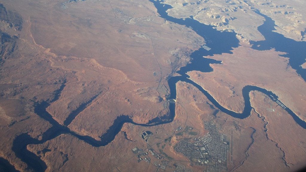
Filling it was slower than anyone expected: Lake Powell began filling on March 13, 1963 and completed filling on June 22, 1980 reaching elevation 3,700 feet above sea level.
Drought, downstream obligations and sheer volume kept it climbing for seventeen years. It has never since sat comfortably full, and the high-water mark is now a pale band of mineral stain on the canyon walls.
67. Lake Powell's Shoreline Beats the US West Coast
The shape of the reservoir is the strange part: Lake Powell has an exceptionally long shoreline for a lake of its size – about 1,960 miles at full pool, longer than the entire west coast of the continental United States.
That is what happens when you flood a canyon system rather than a basin: every side canyon becomes an inlet. The Park Service counts just a handful of marinas along the whole of it.
68. Spiral Jetty Is 1,500 Feet of Basalt in a Salt Lake
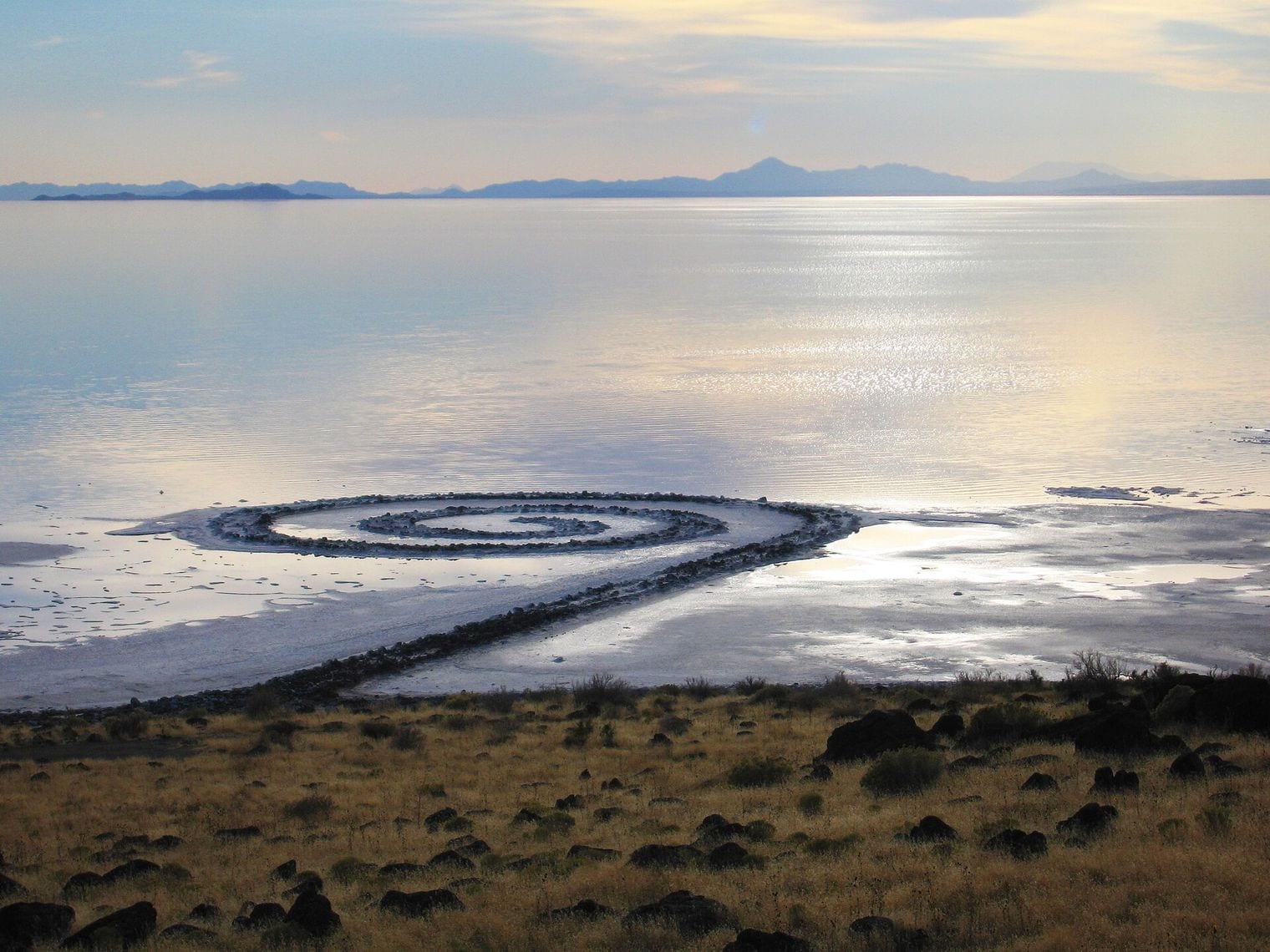
Robert Smithson built it into the lake itself. Using over six thousand tons of black basalt rocks and earth from the site, Smithson formed a coil 1,500 feet long and 15 feet wide that winds counterclockwise off the shore into the water.
For decades it was underwater and effectively invisible. Falling lake levels brought it back, encrusted in salt, and it now sits well back from the waterline it was built to meet.
69. Utah Has an Official State Work of Land Art
In 2017 Utah named Spiral Jetty its official state work of land art — a category almost no other state bothers to have. The Dia Art Foundation is the owner and steward of Robert Smithson's Spiral Jetty.
The designation is odd and rather good: a state formally adopting an earthwork that spends years at a time submerged, on a shore two hours from the nearest town.
70. Monument Valley Is Navajo Land, Not a National Park
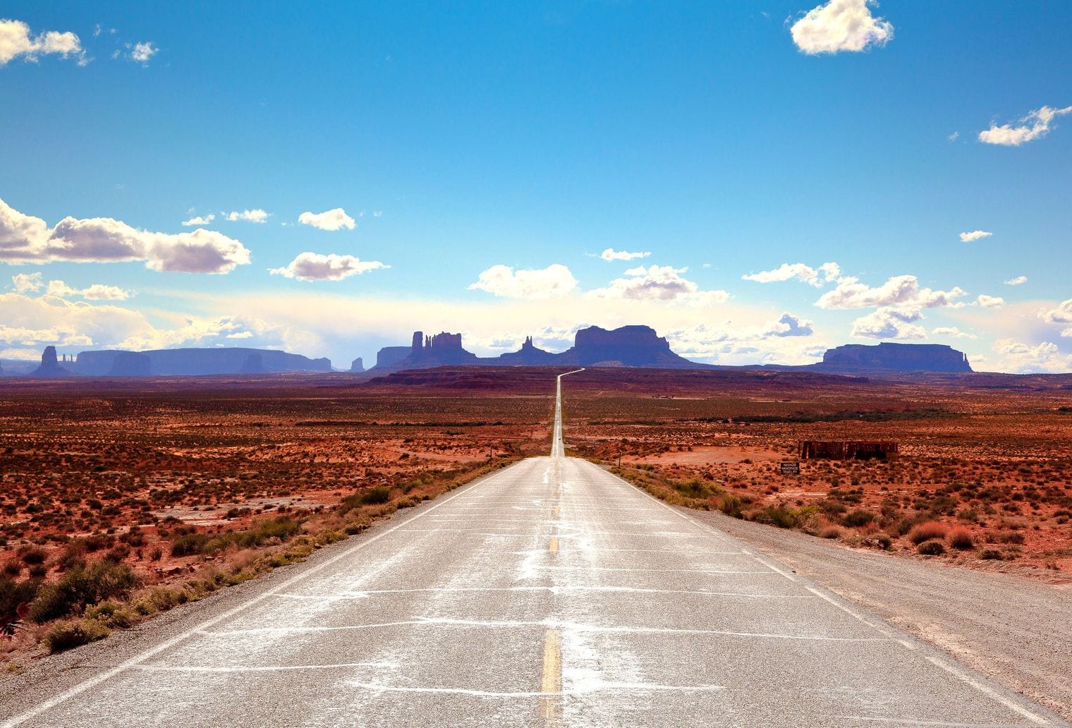
The most photographed landscape in the American West is not federal. It is run by the Navajo Nation, whose parks service gives the Navajo Name: Tse Bii Ndzisgaii and operates it as a tribal park.
Visitors pay the Nation rather than the Park Service, and the Nation sets the rules about where you may drive and where you need a guide. It is a distinction a great many people arrive without knowing.
71. Salt Lake City Hosted 2,399 Olympic Athletes in 2002
The official record of the Games lists Athletes: 2,399 (886 women, 1,513 men) Events: 78, with the opening ceremony on 8 February 2002.
The city rebuilt roads and rail lines for the event, and the venues did not sit idle once it was over. Utah kept its Olympic sports estate in working order rather than letting it rot, which is why the equipment was there when the bid came round again.
72. Twenty-Two Thousand Volunteers Ran the 2002 Games
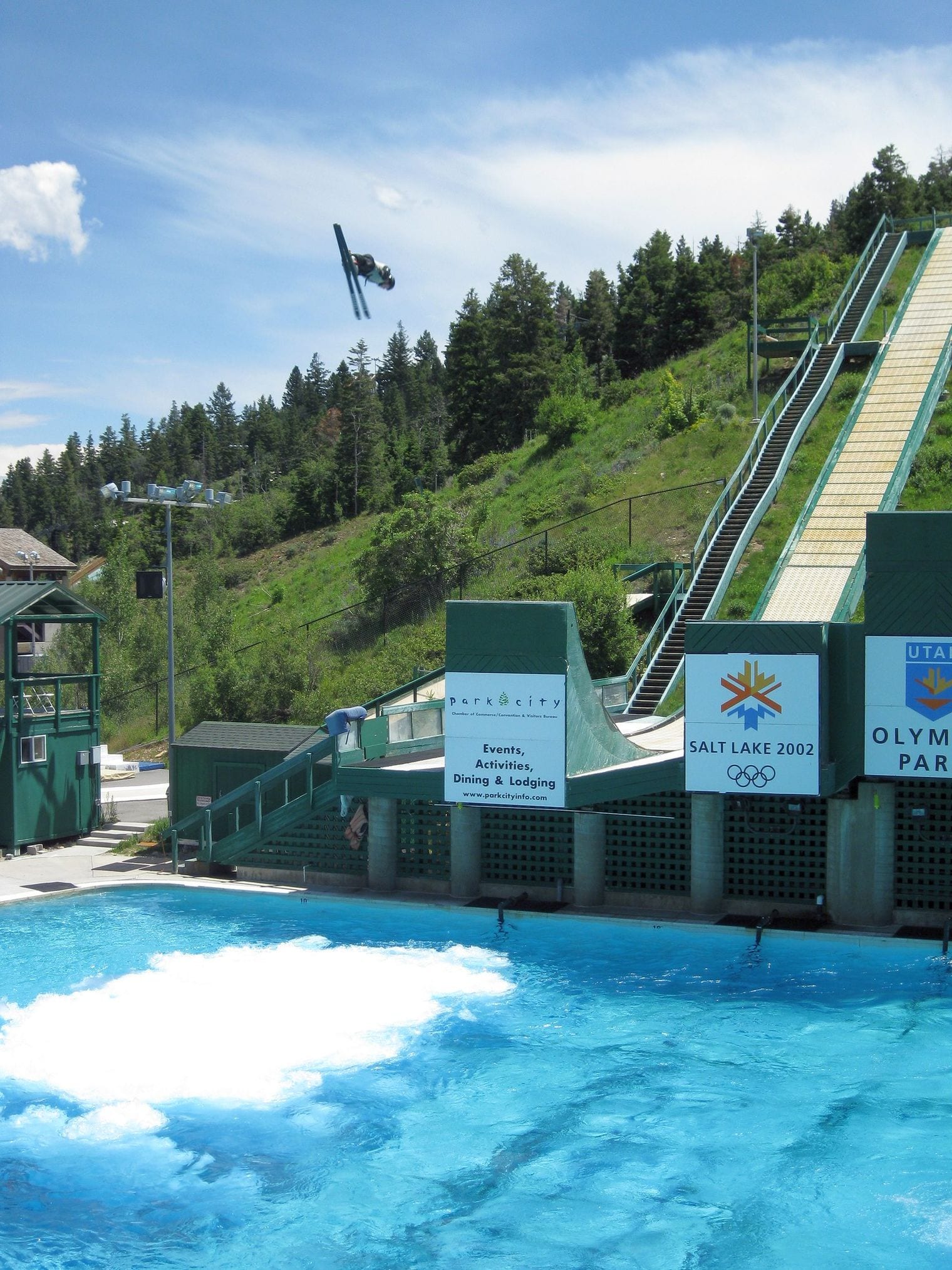
The workforce behind it was almost entirely unpaid: the official tally records Volunteers: 22,000 Media: 8,730 (2,661 written press, 6,069 broadcasters).
That is roughly nine volunteers for every competing athlete. The scale of local participation is part of why the Games are remembered fondly in Utah rather than as an expensive imposition.
73. Arches Is a High Desert of Hot Days and Cold Nights
The park is harsher than the photographs suggest: Arches is in a high desert environment, with hot summer temperatures, cool winters, and infrequent precipitation, and those desert conditions determine the kind of life that can survive there.
The living soil crust between the rocks takes decades to rebuild once broken, which is why the park asks visitors to stay on rock or in washes. A single footprint off-trail outlasts the visit by a long way.
74. Alta Averages 543 Inches of Snow a Winter
The resort's own figure is startling: Alta's mountain is world-renowned for its steep and deep powder skiing, averaging 543 inches of snow each winter.
That is roughly forty-five feet, stacked up in a single canyon. Storms crossing the Great Salt Lake pick up moisture and dump it on the Wasatch, which is the mechanism behind the whole Utah ski industry. Current as of 2026.
75. Two of America's Three Snowboard Bans Are in Utah
The country has almost run out of skiers-only mountains. Deer Valley is one of three remaining American ski resorts that prohibit snowboarders along with Alta and Mad River Glen — and two of the three are Utah resorts.
The bans have survived lawsuits, protests and a bounty offered by a snowboard manufacturer for footage of riders poaching the runs. They remain a policy choice rather than a legal one. That remained the case as of 2026.
76. Alta Has Been Running Since 1939
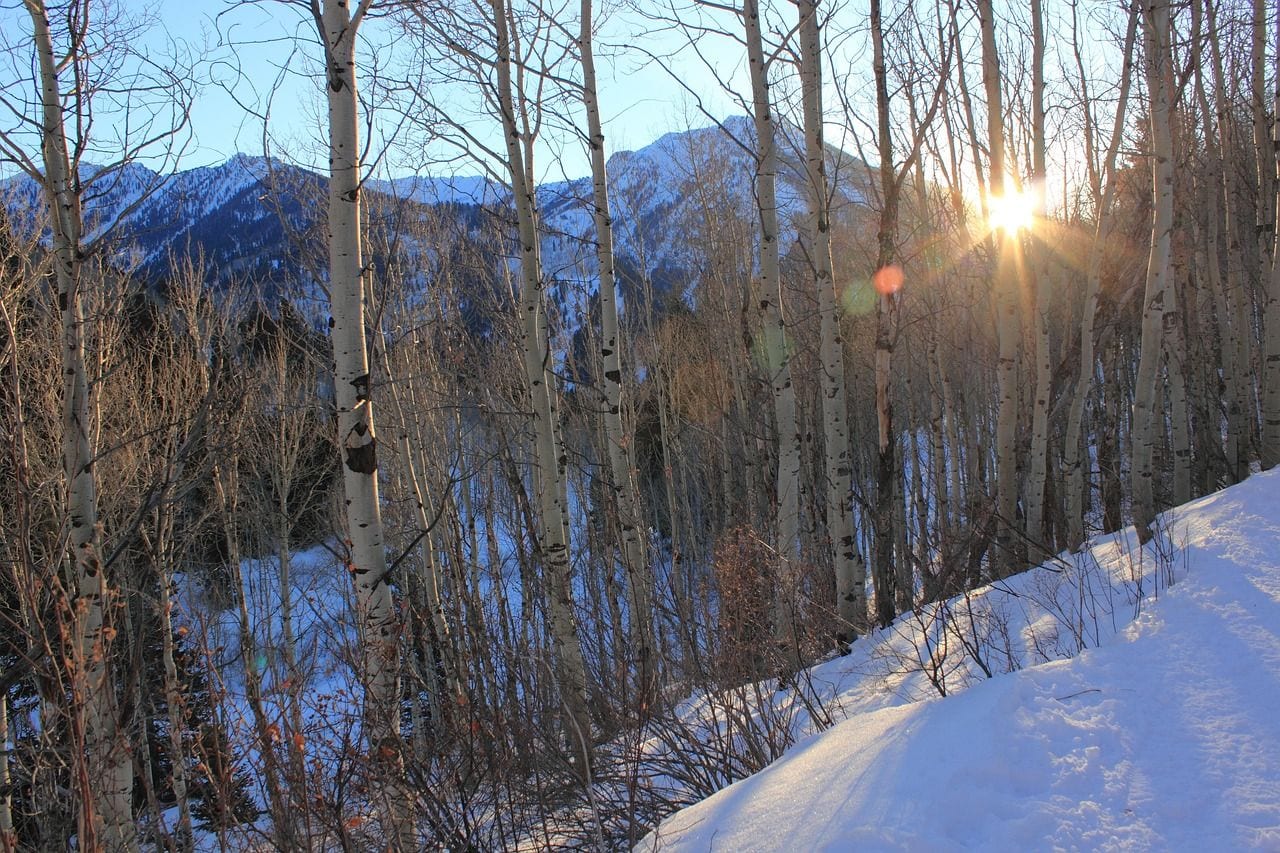
Skiing came here early: Alta Ski Area has been delighting powderhounds since 1939, on ground that had already boomed and died as a silver camp.
The town was almost abandoned when the lift went in, built partly from the wreckage of the mining industry that preceded it. Very few American resorts can claim a continuous run that long.
77. Salt Lake Resorts Average Over 500 Inches of Snow
The canyons above the city are absurdly well supplied: Ski Utah notes that these resorts feature incredible terrain and over 500 inches annually, and that you can stay downtown and be on top of Solitude, Brighton, Alta or Snowbird the same morning.
That combination — a real city with an airport, and deep snow half an hour up the canyon — is genuinely unusual. Good ski terrain usually requires you to move to it. That was still the position as of 2026.
78. Bingham Canyon Is the Largest Hole People Have Dug
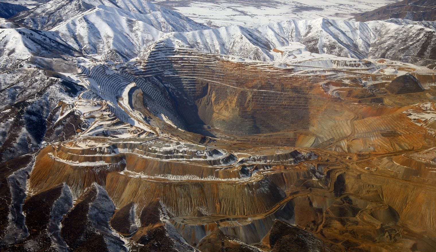
The pit outside Salt Lake City is described as the largest human-made excavation, and deepest open-pit mine in the world, measuring 0.75 miles deep and 2.5 miles wide.
It is visible from the air on the approach into Salt Lake City and reads as a terraced bowl cut into a mountain range. The haul trucks working the benches look like grains of sand from the rim. Current as of 2026.
79. Utah Has Been Mining the Same Ore Body Since 1903
The operation is more than a century old: Kennecott has been mining and processing minerals from the rich ore body of the Bingham Canyon Mine since 1903, and it runs one of only two copper smelters left in the United States.
Copper from this one hole wired a great deal of twentieth-century America. The mine also produces tellurium, which now matters for solar panels — an old industry finding a new reason to exist. That remained the case as of 2026.
80. Monument Valley's Buttes Rise 1,000 Feet Off the Floor
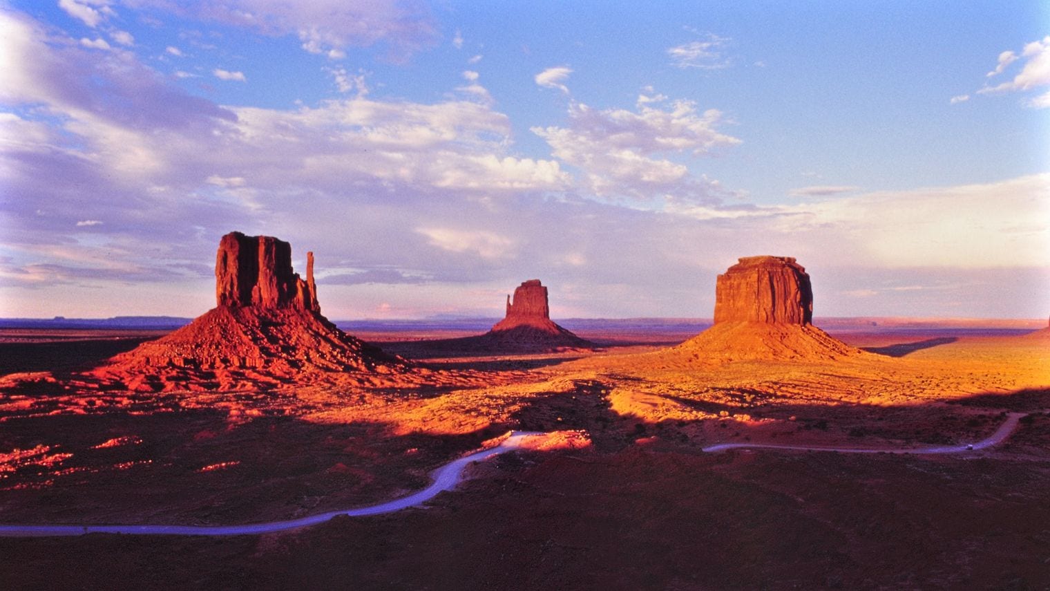
The Navajo Nation's own description gives the scale: the valley boasts sandstone masterpieces that tower at heights of 400 to 1,000 feet, framed by scenic clouds casting shadows that graciously roam the desert floor.
The famous formations are the last remnants of a rock layer that once covered everything here. What you are looking at is not what was built up, but what was left behind.
81. Utah Has the Most Dark Sky Places on Earth
The state tourism office puts it flatly: Utah boasts the highest concentration of certified International Dark Sky Places in the world.
The roster runs from national parks to state parks to whole towns that rewrote their lighting ordinances to qualify. Low population, high elevation and dry air do much of the work; the certifications recognise the places that then chose not to spoil it. That was still the position as of 2026.
82. Timpanogos Cave Was the First Urban Night Sky Place
A small monument on the edge of the Wasatch Front took a first: Timpanogos Cave National Monument has a new designation — the first National Park Service unit to be certified as an Urban Night Sky Place.
The category exists for sites that keep a genuinely dark sky despite sitting inside a city's glow. That a cave monument won it is a nice accident of geography: the canyon walls block the valley lights. Current as of 2026.
83. Newspaper Rock Carries 650 Carvings on One Panel
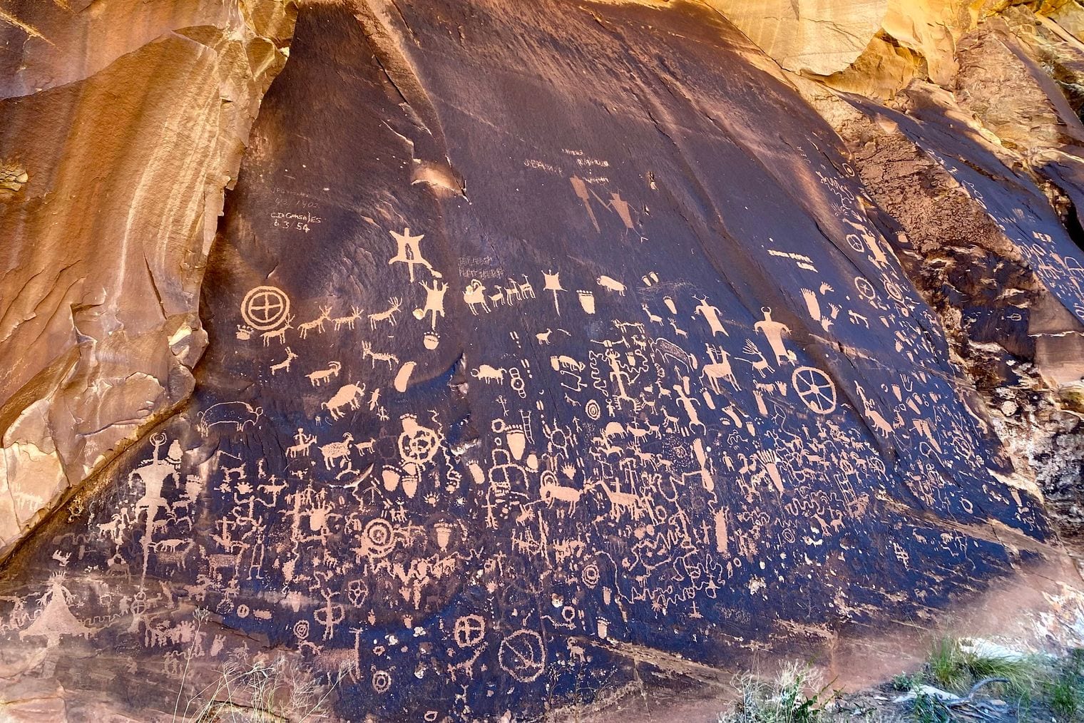
A single dark cliff face beside Indian Creek holds over 650 rock art designs, packed together on one surface.
The rock is coated in desert varnish, a dark mineral skin that carvers cut through to reach the pale stone beneath. That contrast is why the panel reads so clearly, and why people kept returning to the same wall for centuries.
84. One Utah Cliff Records 1,500 Years of Carving
The BLM describes the panel as layered in time: it displays multiple periods of imagery from cultures dating from 1500 years ago to this century, with the lighter, more recent figures attributed to Ute people who still live in the Four Corners area.
It is not one artwork but an accumulation, made by people who were separated from each other by centuries.
85. A Utah Forest Is One Tree With 47,000 Trunks
What looks like a wood is a single organism. In Fishlake National Forest, Pando consists of approximately 47,000 trees in the grove that are genetically identical, all the trees in Pando share a single root system across a 106-acre thicket.
Aspens spread by sending up suckers from their roots rather than by seed, so a grove can be one individual. Pando is simply the largest anyone has identified.
86. Pando May Be the Heaviest Living Thing on Earth
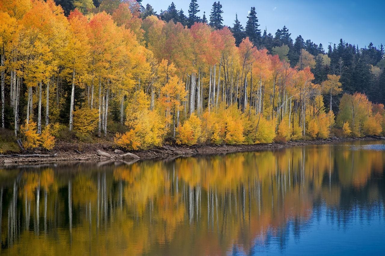
The mass is the astonishing part: Pando is believed to weigh more than 6,600 tons, making Pando the heaviest organism on Earth.
The hedge matters — competing claims exist depending on how you define an organism, and a fungal mat in Oregon covers more ground. By weight, though, this grove is the one that keeps winning, and it is quietly failing: deer and elk eat the young shoots faster than they can replace the old trunks. Current as of 2026.
87. One Utah Monument Rewrote the End of the Dinosaurs
According to the agency that manages it, at Grand Staircase-Escalante fossil excavations have yielded more information about ecosystem change at the end of the dinosaur era than any other place in the world.
The rock here spans the last stretch of the age of dinosaurs in unusual completeness, and the badlands are still producing species new to science faster than they can be described. That remained the case as of 2026.
88. Grand Staircase Was the First Monument the BLM Ran
It broke the pattern of how America protects land: Grand Staircase–Escalante is the first and largest national monument managed by the BLM rather than the Park Service.
That matters on the ground. A BLM monument keeps grazing, roads and multiple use in the mix, so the visitor experience is far less managed — few signs, fewer rangers, and a great deal of country you are simply trusted with. That figure is current as of 2026.
89. Dead Horse Point Looks Down 2,000 Feet of Canyon
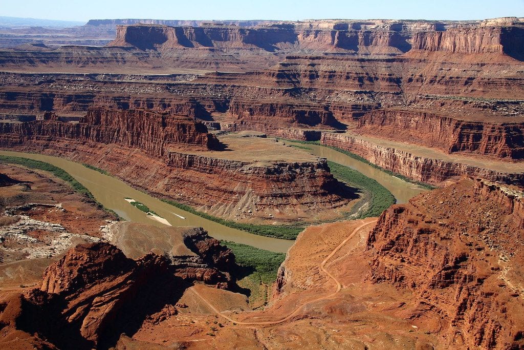
The overlook sits above a gooseneck of river: the park offers views of Moab, the La Sal Mountains to the south and the Colorado River, 2,000 feet below.
The point is reached across a neck of land a few dozen yards wide, which is how it got its grim name: cowboys used the neck as a natural corral, and horses left on the mesa did not always come off it.
90. John Ford Shot His Westerns on a Utah Ranch
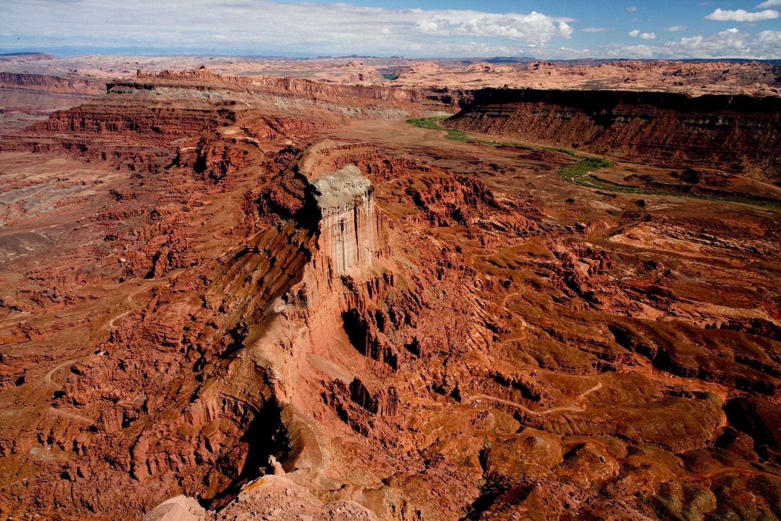
Moab courted the film industry deliberately. Its Film Commission was founded to support filmmakers like the legendary director John Ford who filmed many movies at Red Cliffs Lodge, including "Wagon Master" (1950), "Rio Grande" (1950), and "Cheyenne Autumn" (1964).
Ford had already made Monument Valley famous. Moab gave him river, cliff and mesa within driving distance of a hotel, and the town has been renting out its scenery ever since.
91. Kanab Calls Itself Little Hollywood
The town leans into it: this scenery and rich heritage has lured filmmakers to Kanab for nearly 80 years, and abandoned film sets near town have become tourist attractions in their own right.
Movie posters and signed photographs hang in shopfronts along the main street, and a free museum preserves the surviving sets. It is a small town that decided its second industry was its own back catalogue. That remained the case as of 2026.
92. Utah Rents Out 84,000 Square Miles of Scenery
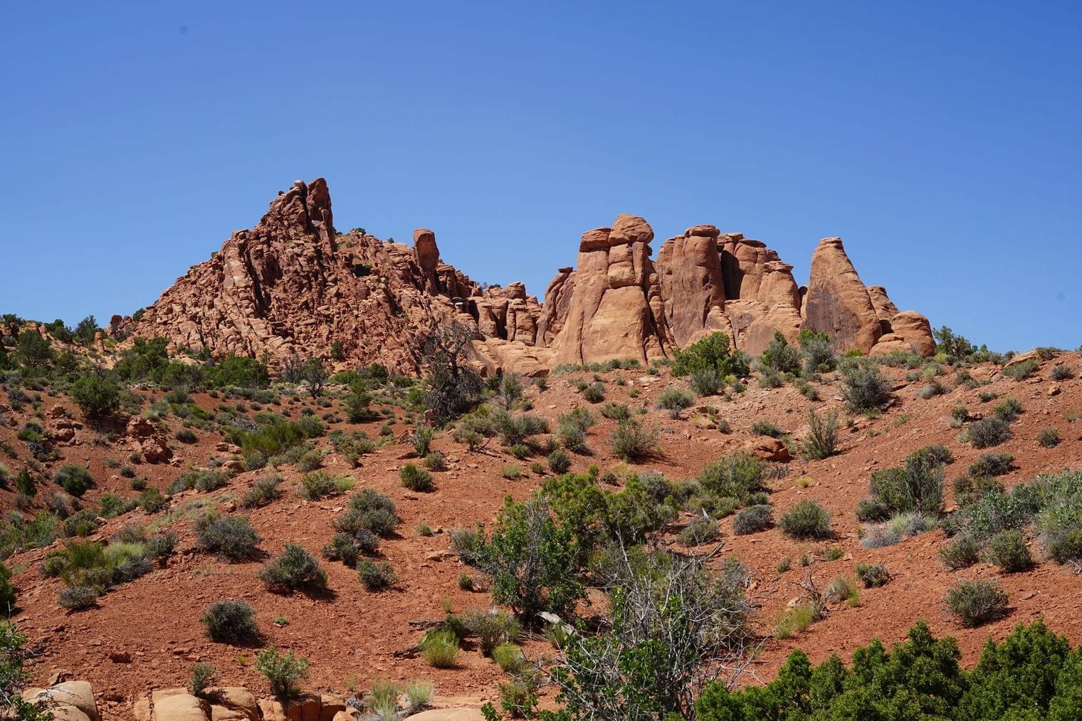
The state film commission makes the pitch in numbers: Utah offers a competitive incentive program, trained crews, professional vendors, and over 84,000 square miles of diverse and unique landscapes.
That range is the real product. Within a day's drive a production can find red desert, alpine forest, salt flat, slot canyon and small-town main street, which is why so many films set elsewhere were actually shot here. That figure is current as of 2026.
93. Utah Was the First State to Drop the Limit to 0.05
Utah moved before anyone else: Utah became the first state in the nation to lower its legal Blood Alcohol Concentration (BAC) limit for driving from 0.08 to 0.05, a threshold that took effect at the end of 2018.
The change was fiercely argued at the time and closely watched afterwards by other states. It remains the strictest standard in the country, and it catches visitors out more often than residents. That was still the position as of 2026.
94. Lake Powell Is Served by Only Three Marinas
For a reservoir with that much shoreline, the infrastructure is thin: there are currently three marinas on Lake Powell, two of them with ramps where you can launch a private vessel.
Falling water has closed ramps and forced marinas to move, so the count is a live figure rather than a fixed one. Many of the lake's side canyons have no facilities of any kind. Current as of 2026.
95. Dust Off the Drying Lakebed Is Now a Health Worry
The exposed lakebed has become a public health question. The USGS is studying dust from the Great Salt Lake dry lakebed: a possible health risk for communities in northern Utah.
The sediments hold metals concentrated over a long time, and the wind that picks them up blows straight towards the Wasatch Front and the cities strung along it. It is the consequence of a shrinking lake that reaches people who never visit it. That remained the case as of 2026.
96. Canyonlands Is Carved by Water in a Place With None
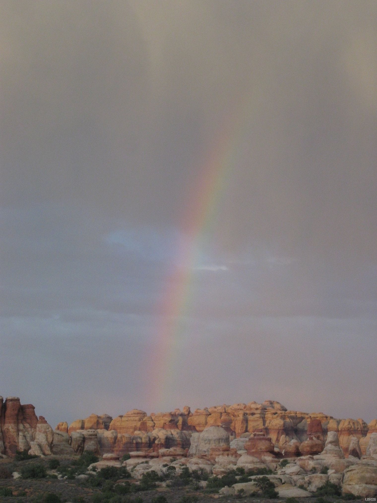
The Park Service frames the paradox neatly: at Canyonlands we see geological processes at work creating the canyons, river corridors, and rock formations, in a desert environment that determines what can live there.
Everything you look at was made by water, and there is almost none of it. The Green and the Colorado run through the middle of the park largely unnoticed by the country they carved.
97. Utah Sand Dunes Rise Nearly 700 Feet
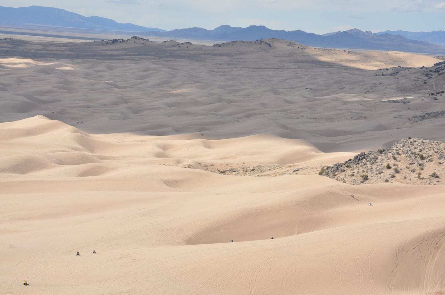
In central Utah the Little Sahara Recreation Area holds a dune worth the name: the BLM notes that Sand Mountain rises nearly 700 feet and is a must-ride for experienced enthusiasts.
The sand blew in from the remains of an ancient river delta and piled against the hills. It is one of the odder landscapes in a state full of them — a genuine sand sea, hours from the red rock people come for.
98. Utah’s State Fossil Was a 28-Foot Predator
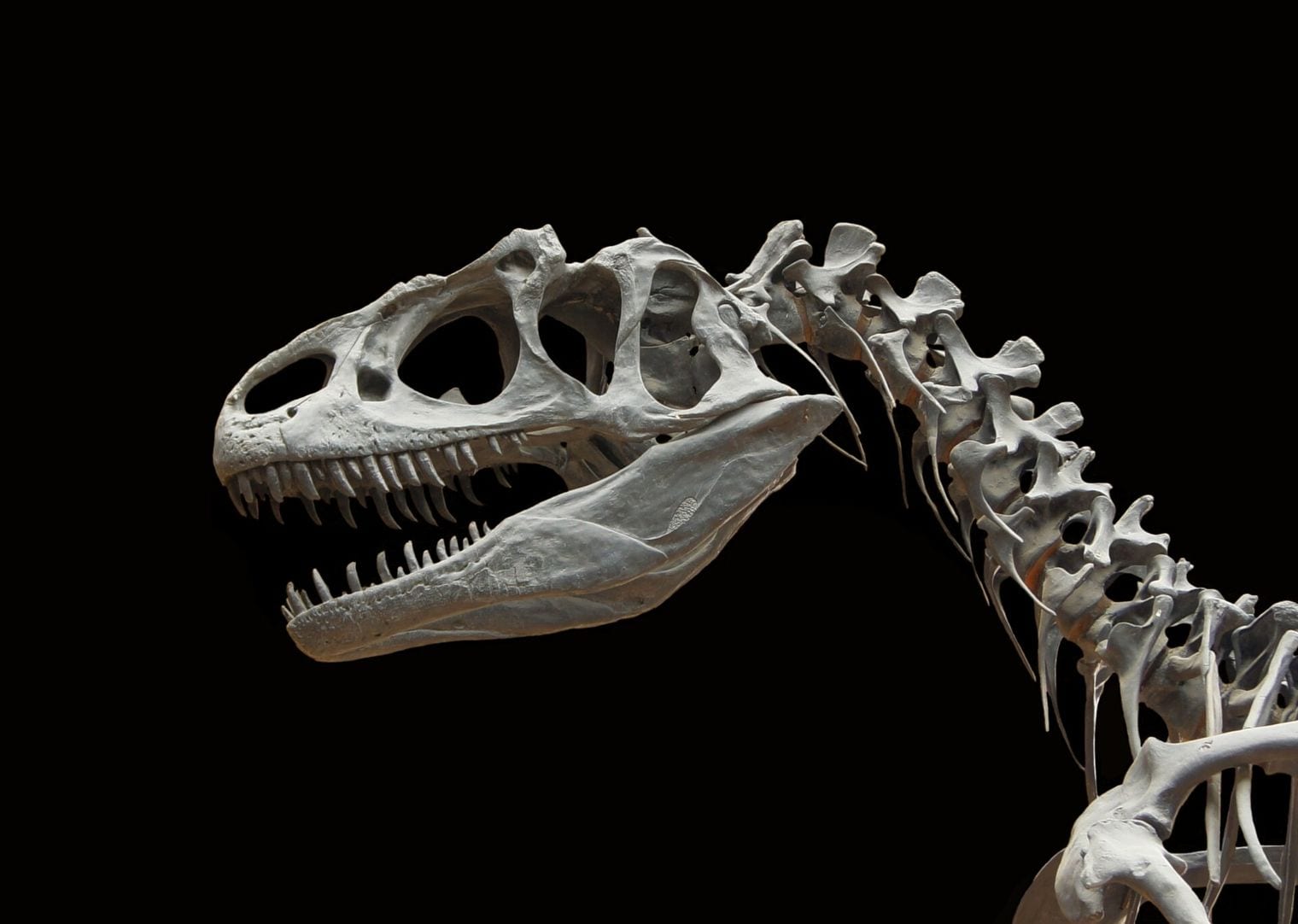
The Natural History Museum of Utah introduces it this way: long before Tyrannosaurus rex reigned supreme, another intimidating predator ruled in the area that is now Utah — Allosaurus fragilis, an animal that averaged 8.5 meters (28 ft) in length.
It was the dominant hunter of its world tens of millions of years before T. rex existed, and Utah has produced enough of them to work out how the species grew up.
99. Utah Is One of the Few States With an Official Star
Most states stop at a bird and a flower. Utah went further: Dubhe is the official star of the State of Utah, listed by the state alongside its other emblems as the State Star.
Dubhe is one of the two pointers at the lip of the Big Dipper — the pair that lead the eye to Polaris. It is a genuinely useful star to adopt, and on a clear Utah night it is impossible to miss.
100. Utah Also Claims a Star Cluster as a State Symbol
The state did not stop at one: its official astronomical symbol is the Beehive Cluster located in the constellation of Cancer the Crab, chosen to echo the beehive on the state emblem.
The cluster is one of the nearest to Earth and, under dark skies, looks like a small nebulous object to the naked eye, and has been known since ancient times. Utah’s dark skies make it a good place to go and find it.
Where to Go Next in Utah
Many of the facts above attach to somewhere you can actually stand — a quarry wall, a salt flat, a grove of aspens that turns out to be one tree. If you want to turn the list into an itinerary, our guide to things to do in Utah covers the parks, the canyons and the towns worth building a trip around.
For everything else the state has on offer, including our city guides to Moab, Provo and St George, start from the Utah hub.
How We Checked These Facts
Every claim on this page carries at least two sources drawn from different kinds of authority, and at least one of them is an official record rather than an encyclopedia — the National Park Service, the Bureau of Land Management, the Bureau of Reclamation, the USGS gauge network, the Utah state government and its agencies, and the institutions that keep the relevant registers.
We record the date we read each source, because several of these numbers move: the Great Salt Lake's level and salinity in particular are read off a live gauge and are true only as of the date given beside them. Where a source hedges, we hedge exactly as hard — if the record says "believed to" or "one of the densest", so do we, rather than rounding a qualified claim up into a flat one.
FAQ: Interesting Facts About Utah
Which is Utah's largest national park?
Canyonlands, at 337,598 acres of land and water. It is also the least visited of the five, largely because it is split into districts that no road connects.
How salty is the Great Salt Lake?
It varies enormously with the water level. Salinity in the main basin ranges from 5 to 27%, and the northern arm — cut off by a railway causeway — is substantially saltier still.
What is the largest living thing in Utah?
An aspen grove called Pando, in Fishlake National Forest. It has approximately 47,000 genetically identical trunks sharing one root system and is believed to weigh more than 6,600 tons, which makes it a strong candidate for the heaviest organism on Earth.
Why is Bryce Canyon not really a canyon?
Because nothing carved it lengthways. A canyon is cut by a stream running through it; Bryce is a set of natural amphitheatres eaten backwards into the edge of a plateau by frost and runoff.
What is the coldest temperature ever recorded in Utah?
Minus 69.3 °F, at Peter Sinks in the Bear River Range on 1 February 1985 — the second-lowest reading ever taken in the contiguous United States. It is an uninhabited sinkhole that traps cold air with nowhere to drain.
Which states meet Utah at Four Corners?
Colorado, Arizona and New Mexico. It is the only location in the United States where four states meet, and the monument itself is administered by the Navajo Nation.
Does Utah really have the darkest skies in the country?
By one measure, yes: Utah has the highest concentration of certified International Dark Sky Places in the world, a roster that runs from national parks to state parks to entire towns that rewrote their lighting rules to qualify.