From the Boundary Waters to Lake Superior's crashing surf, this is a state built for a canoe, a car and a long summer's evening light.
Minnesota is the land of lakes and big water — more than 11,000 lakes, the wild canoe country of the Boundary Waters, the north woods of Voyageurs National Park, and Lake Superior's rugged North Shore, all anchored by the Twin Cities of Minneapolis and St Paul. Use this hub to plan your trip: browse our city guides below for the headline sights, or read on for the regions, seasons and road trips that tie the state together.
Known for
Lakes, north woods & the North Shore
Best for
Canoeing, hiking & city culture
Capital
St Paul
Largest city
Minneapolis
Main gateway
Minneapolis–St Paul Int'l (MSP)
Time zone
Central (CT)
Trip planner
Plan your trip to Minnesota
Best time to visit — season by season
Spring
Mar–May
A slow, muddy thaw: ice comes off the lakes through April, waterfalls run full along the North Shore, and the first warm days arrive late. Pack layers — snow can still fall in the north into May.
Summer
Jun–Aug
The season Minnesota lives for. Long daylight, warm lakes and green forests open the Boundary Waters, the North Shore and every cabin dock. Days are warm and humid statewide, with occasional thunderstorms rolling across the prairie.
Fall
Sep–Oct
Prime time up north: crisp air and blazing maple-and-birch colour along the North Shore and the Superior forests, usually peaking late September to early October. Crowds thin and the biting insects finally quit.
Winter
Nov–Feb
Long, genuinely cold and snowy — the north can drop well below 0°F. It's also when Minnesotans head outdoors: cross-country skiing, snowshoeing, ice fishing on the frozen lakes and the Twin Cities' skyway-warmed winter festivals.
Regions of Minnesota
The Twin Cities
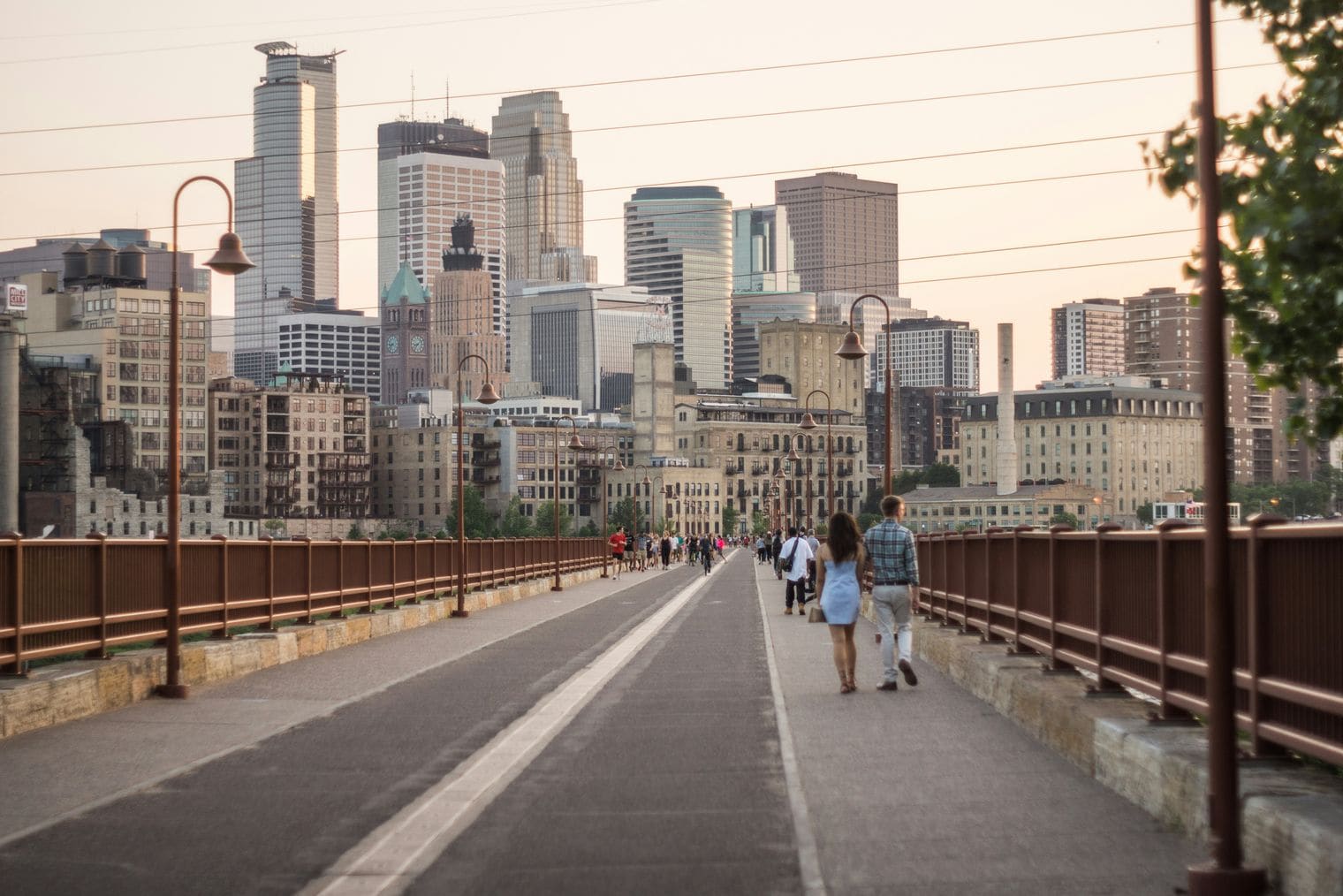
Minnesota's cultural and economic core, where Minneapolis pairs the Mississippi riverfront, the Chain of Lakes and world-class art museums with neighbouring St Paul, the state capital, and the giant Mall of America just to the south.
The North Shore & Lake Superior
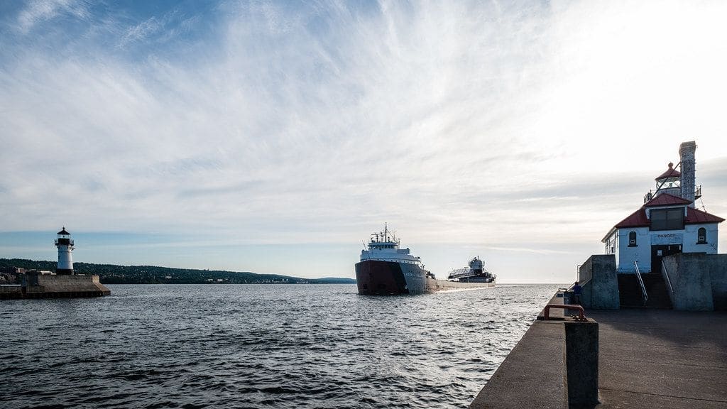
The state's most scenic drive, running Highway 61 north-east from Duluth past Gooseberry Falls, Split Rock Lighthouse, Tettegouche and the Sawtooth Mountains to Grand Marais and the Canadian border.
The Arrowhead & Boundary Waters
Minnesota's wild north-eastern corner, home to the Boundary Waters Canoe Area Wilderness, Voyageurs National Park and the old Iron Range mining towns — canoe country reached from gateways like Ely and Grand Marais.
Central lakes & the Mississippi headwaters
The heart of cabin-and-lake Minnesota, from Brainerd and the Alexandria lakes to Itasca State Park, where the Mississippi River begins as a stream you can wade across.
Southern Minnesota & the bluff country
The gentler south, where Rochester (home of the Mayo Clinic) meets the limestone river valleys of the Driftless Area, the Root River bike trail and the German-and-Czech towns of the Minnesota River.
Getting around
A rental car is essential for everything beyond the Twin Cities: the lakes, the North Shore and the north-woods parks are spread across a big state and thinly served by transit. Minneapolis–St Paul International is the main gateway, and the Twin Cities themselves have light rail and buses connecting the airport, downtowns and Mall of America. From there it's roughly a two-and-a-half-hour drive north to Duluth, where Highway 61 begins the scenic run up the Lake Superior shore. Distances are long once you leave the interstates, and services thin out in the far north, so fuel up before heading into canoe country.
The highlights Minnesota's signature sights & road trips
Boundary Waters Canoe Area Wilderness A million-plus acres of interconnected lakes and portages on the Canadian border — the premier canoe-camping wilderness in the country.
Voyageurs National Park A water-based park of island-studded northern lakes best explored by boat, with dark skies for the northern lights.
Itasca State Park Minnesota's oldest state park and the headwaters of the Mississippi, where you can wade across the great river at its source.
Minnesota's classic road trip, following Highway 61 up the Lake Superior coast from the Twin Cities through Duluth to the Canadian border. Best in summer or during the autumn colour; run it out and back, or loop inland on the return.
Gooseberry Falls State Park — first great waterfall stop
Split Rock Lighthouse State Park — the iconic clifftop lighthouse
Tettegouche State Park — high falls and Sawtooth ridges
Grand Marais — harbour-town finish near the border
Twin Cities & the lakes weekend
3–4 days
A city-and-water long weekend pairing the culture of Minneapolis and St Paul with the Mississippi riverfront and the Chain of Lakes — easy to do car-light using light rail before heading out to cabin country.
Summer, from June through August, is the classic season — warm lakes, long daylight and everything open, from the Boundary Waters to the cabin country. Early autumn (late September into October) is arguably even better up north, with brilliant fall colour along the North Shore and thinner crowds. Winter is long and very cold, but rewarding if you come for skiing, ice fishing or the Twin Cities' winter festivals.
How many days do you need in Minnesota?
A long weekend in the Twin Cities covers the museums, riverfront and Mall of America comfortably. To add the North Shore — driving up Highway 61 from Duluth toward Grand Marais — plan on four to six days. A fuller trip that also reaches the Boundary Waters or Voyageurs National Park in the far north is better given a week or more, since the distances are long.
Do you need a car in Minnesota?
For the Twin Cities alone, not really — Minneapolis and St Paul have light rail and buses linking the airport, downtowns and Mall of America. But for everything else, a rental car is essential: the lakes, the North Shore and the northern parks are spread across a big state and barely served by transit. Most visitors fly into Minneapolis–St Paul International and drive from there.
What is Minnesota best known for?
Minnesota is famous as the 'Land of 10,000 Lakes' — it actually has more than 11,000 — along with the Boundary Waters canoe wilderness, the rugged Lake Superior North Shore, the source of the Mississippi River at Lake Itasca, and the Twin Cities of Minneapolis and St Paul with the enormous Mall of America.
What is the best drive in Minnesota?
The North Shore Scenic Drive along Highway 61 is the standout. It runs north-east from Duluth up the Lake Superior coast, passing Gooseberry Falls, Split Rock Lighthouse, Tettegouche State Park and the Sawtooth Mountains before reaching Grand Marais and the Canadian border. It's spectacular in summer and at its best during the autumn colour.
Where is the Boundary Waters, and do you need a permit?
The Boundary Waters Canoe Area Wilderness sits along Minnesota's border with Canada in the state's north-eastern Arrowhead, most often reached from the gateway towns of Ely or Grand Marais. Overnight trips require a quota permit from the U.S. Forest Service, and the summer permits are limited and reserved in advance, so plan ahead. Rules change from year to year, so always check the current requirements before you go.
How cold does Minnesota get in winter?
Very cold. Winters are long, and temperatures across the northern half of the state regularly fall below 0°F, with heavy snow. The Twin Cities are milder but still snowy, which is why downtown Minneapolis is famous for its enclosed skyways. If you visit in winter, come prepared for genuine cold — and for the outdoor activities Minnesotans build the season around.
Is Minnesota in one time zone?
Yes — the entire state is in the Central Time Zone and observes daylight saving time, so there's no clock change to worry about as you travel between the Twin Cities, Duluth and the north woods.
We use cookies to analyse site traffic and improve your experience.
You can accept or reject analytics cookies. See our Cookie Policy.